Latitude: 54.3445 / 54°20'40"N
Longitude: -2.8478 / 2°50'52"W
OS Eastings: 344982
OS Northings: 494660
OS Grid: SD449946
Mapcode National: GBR 8LK6.7C
Mapcode Global: WH82V.7248
Plus Code: 9C6V85V2+RV
Entry Name: Tower of Old Parish Church of St Catherine
Listing Date: 28 March 1984
Grade: II
Source: Historic England
Source ID: 1336066
English Heritage Legacy ID: 76395
ID on this website: 101336066
Location: Westmorland and Furness, Cumbria, LA8
County: Westmorland and Furness
District: South Lakeland
Town: South Lakeland
Civil Parish: Crook
Traditional County: Westmorland
Lieutenancy Area (Ceremonial County): Cumbria
Church of England Parish: Crook St Catherine
Church of England Diocese: Carlisle
SD 49 SW CROOK
7/12 Tower of Old Parish Church of St Catherine II
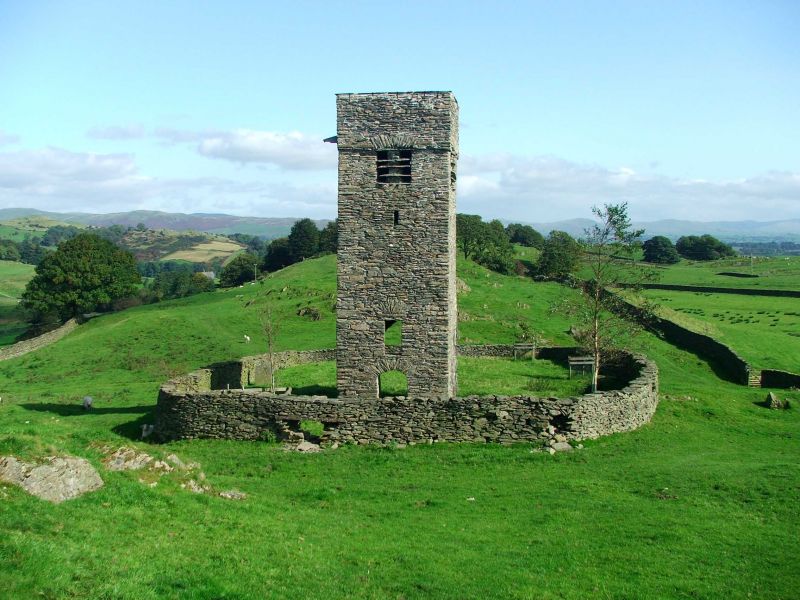
Church Tower, said to have been built in 1620. The remainder of the church was pulled down in 1887. Rubble walls, plain parapet. Partly blocked segmental arch and blocked doorway with segmental head on ground floor; 2 slit lights to 2nd floor; plain rectangular openings with stone louvres to belfry. RCHM page 72. Ancient Monument No. 108.
Listing NGR: SD4498294659


Other nearby listed buildings