Latitude: 51.3886 / 51°23'19"N
Longitude: 0.5019 / 0°30'6"E
OS Eastings: 574174
OS Northings: 168481
OS Grid: TQ741684
Mapcode National: GBR PPN.V0L
Mapcode Global: VHJLT.NC59
Plus Code: 9F329GQ2+FQ
Entry Name: Stretch of Precinct Wall Forming Part of the Diocesan Registry Stretch of Precinct Walling Extending Along East Side of Boley Hill from a Point Immediately South West of the Diocesan Registry (The Pre
Listing Date: 2 December 1991
Grade: II
Source: Historic England
Source ID: 1336101
English Heritage Legacy ID: 172930
ID on this website: 101336101
Location: Rochester, Medway, Kent, ME1
County: Medway
Electoral Ward/Division: Rochester West
Parish: Non Civil Parish
Built-Up Area: Rochester
Traditional County: Kent
Lieutenancy Area (Ceremonial County): Kent
Church of England Parish: Rochester St Peter Parish Centre
Church of England Diocese: Rochester
Tagged with: Wall
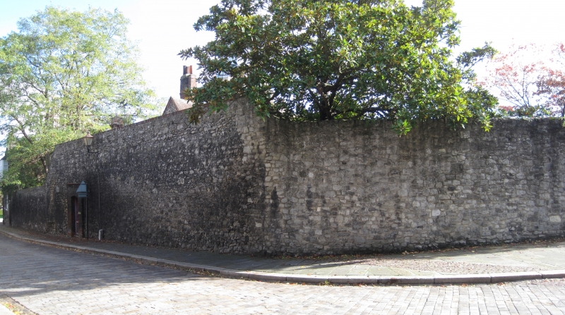
ROCHESTER BOLEY HILL TQ 7468 King's Head Hotel (see under High Street) TQ 7468 NW AND TQ 7468 SW ROCHESTER BOLEY HILL 7/3 AND 9/3 Stretch of Precinct walling extending along east side of Boley Hill from a point immediately south- west of the Diocesan Registry (The Precinct qv) to (and including) The King's School Craft Centre GV II Wall bounding that part of the cathedral precinct originally occupied by the Bishops' Palace. Partly medieval, much renewal. Random rubble ragstone and clunch. Varies in height from 3.5 to 7m; 4 later gateways knocked through. At the S end the wall returns to form the outer and lower courses of a late-C19 2- storeyed craft workshop.
Listing NGR: TQ7419368520
External links are from the relevant listing authority and, where applicable, Wikidata. Wikidata IDs may be related buildings as well as this specific building. If you want to add or update a link, you will need to do so by editing the Wikidata entry.


Other nearby listed buildings