Approximate Location Map
Large Map »
Latitude: 51.2724 / 51°16'20"N
Longitude: 0.5195 / 0°31'10"E
OS Eastings: 575847
OS Northings: 155593
OS Grid: TQ758555
Mapcode National: GBR PR7.06F
Mapcode Global: VHJMD.Y8JY
Plus Code: 9F327GC9+WR
Entry Name: 57, High Street
Listing Date: 2 August 1974
Grade: II
Source: Historic England
Source ID: 1336176
English Heritage Legacy ID: 173349
ID on this website: 101336176
Location: Maidstone, Kent, ME14
County: Kent
District: Maidstone
Electoral Ward/Division: High Street
Parish: Non Civil Parish
Built-Up Area: Maidstone
Traditional County: Kent
Lieutenancy Area (Ceremonial County): Kent
Tagged with: Building
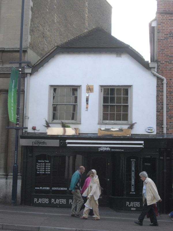
HIGH STREET
1.
5278
(South East Side)
No 57
TQ 7555 NE 1/278
II GV
2.
C18 refronted. 2 storeys stuccoed. Hipped tiled roof and parapet. I altered
C19 window and modern shopfront. The rear elevation has a timber-framed building
in the yard.
Nos 55 to 57 (consec) form a group.
Listing NGR: TQ7584855590
External links are from the relevant listing authority and, where applicable, Wikidata. Wikidata IDs may be related buildings as well as this specific building. If you want to add or update a link, you will need to do so by editing the Wikidata entry.


Other nearby listed buildings
