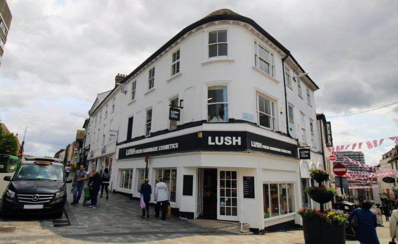
Latitude: 51.2738 / 51°16'25"N
Longitude: 0.5235 / 0°31'24"E
OS Eastings: 576116
OS Northings: 155758
OS Grid: TQ761557
Mapcode National: GBR PR7.15X
Mapcode Global: VHJMF.173W
Plus Code: 9F327GFF+G9
Entry Name: 1 and 3, Gabriel's Hill
Listing Date: 2 August 1974
Grade: II
Source: Historic England
Source ID: 1336209
English Heritage Legacy ID: 173319
ID on this website: 101336209
Location: Maidstone, Kent, ME14
County: Kent
District: Maidstone
Electoral Ward/Division: High Street
Parish: Non Civil Parish
Built-Up Area: Maidstone
Traditional County: Kent
Lieutenancy Area (Ceremonial County): Kent
Tagged with: Building
GAERIEL'S HILL 1. 5278 (North-East Side) Nos 1 & 3 TQ 7655 NW 2/252 II GV
2. Mid C19. 3 storeys cement rendered. Wide bracket eaves cornice. 3 sashes to No 3 and 1 triple sash to No 1. The 2nd floor has glazing bars intact but no glazing bars to the windows on the other floors. Modern shopfront. A plaque to No 3 recovds the previous existence on the site of the Old Bell Inn where Pepys stayed in 1669. 4 sashes to King Street elevation. Mediaeval undercroft of 10 bays having a blocked stone newel staircase and 2 ogee-headed niches.
Nos 1 to 15 (odd) form a group. Also forms a group with Nos 2 & 4 King Street.
Listing NGR: TQ7612255755
External links are from the relevant listing authority and, where applicable, Wikidata. Wikidata IDs may be related buildings as well as this specific building. If you want to add or update a link, you will need to do so by editing the Wikidata entry.


Other nearby listed buildings