Latitude: 51.4062 / 51°24'22"N
Longitude: 0.5254 / 0°31'31"E
OS Eastings: 575743
OS Northings: 170490
OS Grid: TQ757704
Mapcode National: GBR PPH.TXD
Mapcode Global: VHJLN.2X3D
Plus Code: 9F32CG4G+F5
Entry Name: 12-18, High Street
Listing Date: 14 November 1986
Grade: II
Source: Historic England
Source ID: 1336491
English Heritage Legacy ID: 172876
ID on this website: 101336491
Location: Upper Upnor, Medway, Kent, ME2
County: Medway
Civil Parish: Frindsbury Extra
Traditional County: Kent
Lieutenancy Area (Ceremonial County): Kent
Church of England Parish: Frindsbury All Saints
Church of England Diocese: Rochester
Tagged with: Building
FRINDSBURY EXTRA CP HIGH STREET TQ 77 SE 16/45 South side Upper Upnor Nos 12-18, (Even) GV II
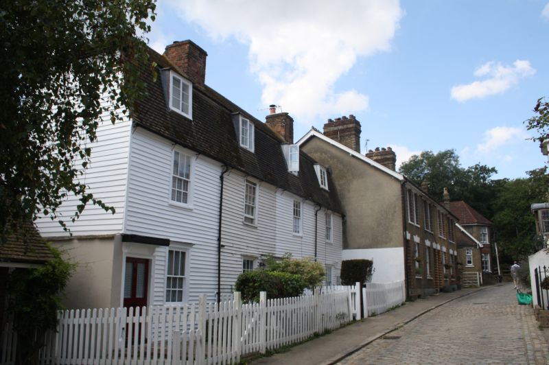
Cottage row. Mid C18. Weatherboarded with tiled gambrel roof. 2 storeys with attic and 4 flat-headed dormers. Regular 4 window front, glazing bar sashes. Boarded doors with flat hoods, paired in centre and singly at each end of front.
Listing NGR: TQ7573770489
External links are from the relevant listing authority and, where applicable, Wikidata. Wikidata IDs may be related buildings as well as this specific building. If you want to add or update a link, you will need to do so by editing the Wikidata entry.


Other nearby listed buildings