Latitude: 51.2444 / 51°14'39"N
Longitude: 1.127 / 1°7'37"E
OS Eastings: 618345
OS Northings: 154112
OS Grid: TR183541
Mapcode National: GBR TYJ.XDF
Mapcode Global: VHLGN.HZ5G
Plus Code: 9F3364VG+PR
Entry Name: Church of St Peter
Listing Date: 30 January 1967
Grade: II*
Source: Historic England
Source ID: 1336512
English Heritage Legacy ID: 171028
Also known as: St Peter's Church, Bridge, Kent
ID on this website: 101336512
Location: St Peter's Church, Bridge, Canterbury, Kent, CT4
County: Kent
District: Canterbury
Civil Parish: Bridge
Built-Up Area: Bridge
Traditional County: Kent
Lieutenancy Area (Ceremonial County): Kent
Tagged with: Church building
1. 5273 BRIDGE HIGH STREET (south-west side)
Church of St Peter TR 1854 19/184 30.1.67
II* GV
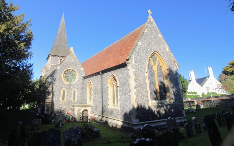
2. Chancel, nave with aisles, tower at west end of the south aisle with broached shingled spire. Stone. Originally a chapel of ease to Patrixbourne, but heavily rebuilt by Scott 1859-61. Norman doorway reset in the north transept, and one to the west wall of the nave with waterlead capitals. Arcades contain some remains of C12 and C13 work. Unusual carved panel of good quality of the Late Perpendicular period in the form of a Norman tympanum reset in chancel wall. Early C16 reclining effigy monument. Body stones to the churchyard and tombstones carved with shells, cherubs' heads and skulls.
Listing NGR: TR1834554112
External links are from the relevant listing authority and, where applicable, Wikidata. Wikidata IDs may be related buildings as well as this specific building. If you want to add or update a link, you will need to do so by editing the Wikidata entry.


Other nearby listed buildings