Latitude: 51.2539 / 51°15'14"N
Longitude: 1.1104 / 1°6'37"E
OS Eastings: 617139
OS Northings: 155121
OS Grid: TR171551
Mapcode National: GBR TYH.CK5
Mapcode Global: VHLGN.6RC4
Plus Code: 9F337436+H4
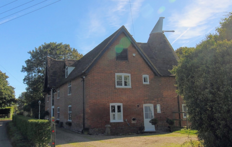
Entry Name: Former Oast House at Renville Farm
Listing Date: 13 September 1977
Grade: II
Source: Historic England
Source ID: 1336570
English Heritage Legacy ID: 171350
ID on this website: 101336570
Location: Canterbury, Kent, CT4
County: Kent
District: Canterbury
Civil Parish: Bridge
Traditional County: Kent
Lieutenancy Area (Ceremonial County): Kent
Tagged with: Drying house
This list entry was subject to a Minor Amendment on 6 October 2025 to update the Name and Address and reformat the text to current standards
TR 15 NE
9/477
PATRIXBOURNE
RENVILLE
Renville Oast
(Formerly listed as DOVER ROAD (west side) Oast House at Renville Farm)
13.9.77
II
Mid C19 oast house with three circular kilns, each complete with cowl, Two storeys in red brick with tiled roof. One dormer window. Six casement windows with diamond panes. Loading door under gable. Part of the Patrixbourne estate development, and in a similar style to the oast in the village.
Listing NGR: TR1930654654
External links are from the relevant listing authority and, where applicable, Wikidata. Wikidata IDs may be related buildings as well as this specific building. If you want to add or update a link, you will need to do so by editing the Wikidata entry.


Other nearby listed buildings