Latitude: 51.0259 / 51°1'33"N
Longitude: 0.5678 / 0°34'4"E
OS Eastings: 580171
OS Northings: 128313
OS Grid: TQ801283
Mapcode National: GBR PV6.LD6
Mapcode Global: FRA D62D.P1L
Plus Code: 9F322HG9+94
Entry Name: Old Well House
Listing Date: 20 June 1967
Last Amended: 5 July 1993
Grade: II
Source: Historic England
Source ID: 1336767
English Heritage Legacy ID: 170326
ID on this website: 101336767
Location: Sandhurst, Tunbridge Wells, Kent, TN18
County: Kent
District: Tunbridge Wells
Civil Parish: Sandhurst
Built-Up Area: Sandhurst
Traditional County: Kent
Lieutenancy Area (Ceremonial County): Kent
Tagged with: House
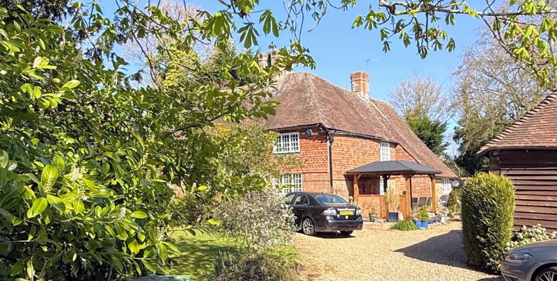
SANDHURST TQ82NW RYE ROAD 1350-0/6/222 (North side) 20/06/67 Old Well House (Formerly Listed as: RYE ROAD (North side) The Homestead) GV II House, at one time an Inn. Probably late C16 timberframed house of lobby entrance type, refaced in C18 with C20 fenestration. Exterior now clad in red brick on ground floor and tile hung above, with 1 band of curved tiles to 2 of plain. Steeply pitched tiled roof with 4 octagonal brick chimneystacks. 2 storeys 4 windows. Casement windows and large C20 gabled porch. Interior not seen.
Listing NGR: TQ8017128313
External links are from the relevant listing authority and, where applicable, Wikidata. Wikidata IDs may be related buildings as well as this specific building. If you want to add or update a link, you will need to do so by editing the Wikidata entry.


Other nearby listed buildings