Approximate Location Map
Large Map »
Latitude: 51.282 / 51°16'55"N
Longitude: 1.0838 / 1°5'1"E
OS Eastings: 615154
OS Northings: 158167
OS Grid: TR151581
Mapcode National: GBR TY2.JV6
Mapcode Global: VHLGM.Q1TK
Plus Code: 9F3373JM+QG
Entry Name: 84, Broad Street
Listing Date: 7 September 1973
Grade: II
Source: Historic England
Source ID: 1336807
English Heritage Legacy ID: 170437
ID on this website: 101336807
Location: Northgate, Canterbury, Kent, CT1
County: Kent
District: Canterbury
Electoral Ward/Division: Westgate
Parish: Non Civil Parish
Built-Up Area: Canterbury
Traditional County: Kent
Lieutenancy Area (Ceremonial County): Kent
Tagged with: Building
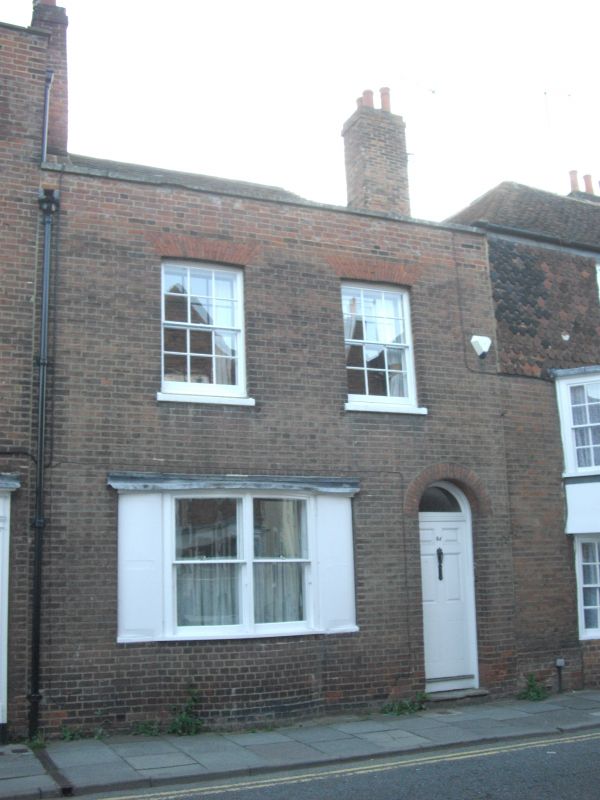
1.
944 BROAD STREET
(South West Side)
No 84
TR 1558 SW 3/295
II GV
2.
Late C18 to early C19. 2 storeys red brick. Hipped tiled roof. Parapet
with stone coping. 2 sashes with glazing bars intact. Stone cills. Ground
floor has double-hung sash in curved bay and shutters. Simple round-headed
doorcase with semi-circular fanlight and 6 Panelled door.
Nos 80 to 89 (consec) form a group.
Listing NGR: TR1515458167
External links are from the relevant listing authority and, where applicable, Wikidata. Wikidata IDs may be related buildings as well as this specific building. If you want to add or update a link, you will need to do so by editing the Wikidata entry.


Other nearby listed buildings
