Latitude: 51.0954 / 51°5'43"N
Longitude: 0.5381 / 0°32'17"E
OS Eastings: 577818
OS Northings: 135968
OS Grid: TQ778359
Mapcode National: GBR PTC.BTK
Mapcode Global: FRA D607.9F9
Plus Code: 9F323GWQ+56
Entry Name: Copthall Cottages
Listing Date: 19 May 1986
Grade: II
Source: Historic England
Source ID: 1336909
English Heritage Legacy ID: 169066
ID on this website: 101336909
Location: Cranbrook, Tunbridge Wells, Kent, TN17
County: Kent
District: Tunbridge Wells
Civil Parish: Cranbrook & Sissinghurst
Built-Up Area: Cranbrook
Traditional County: Kent
Lieutenancy Area (Ceremonial County): Kent
Tagged with: Cottage
CRANBROOK SAINT DAVID'S BRIDGE TQ 7735 NE (north east side) 12/216 No's 1-3 (Incl), Copthall - Cottages GV II
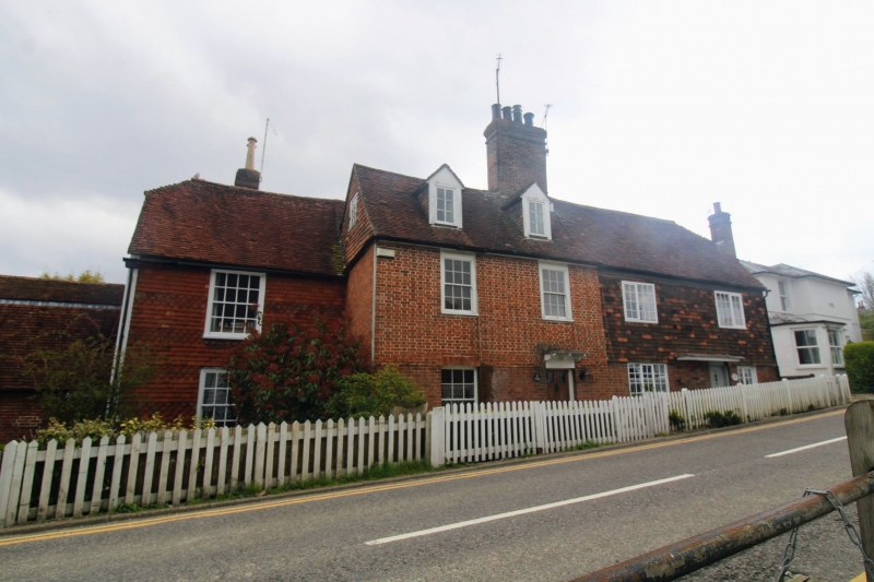
Cottage row. C17. Timber-framed with red brick ground floor and tile-hung first floor, mathematically to left. Plain and decoratively tile-hung wing behind to left with red and blue brick wing beyond to left. Plain tiled roofs, half-hipped to right, half-hipped on wing to left and half-hipped gambrel in further left-hand wing. Large red brick stack to left of centre on main block, and brick stack on hipped wing to rear of inner left hand block. 2 gabled dormers to left on main block. 2 storeys with attic. 1 1/2 storey outer left hand block. Inner left hand block, with 1 window on each floor, glazing bar sashes with open boxes. 4 window main block, slightly irregular, with glazing bar sashes to left and C20 casements to right. Boarded door with leaded pentice hood at right of outer left hand block, (No 1), panelled door with 2 top-lights glazed to left of centre on main block, with flat hood on brackets, (No 2). Panelled door to right of main block with long C20 flat hood, (No 3).
Listing NGR: TQ7781735971
External links are from the relevant listing authority and, where applicable, Wikidata. Wikidata IDs may be related buildings as well as this specific building. If you want to add or update a link, you will need to do so by editing the Wikidata entry.


Other nearby listed buildings