Latitude: 51.097 / 51°5'49"N
Longitude: 0.5367 / 0°32'12"E
OS Eastings: 577719
OS Northings: 136141
OS Grid: TQ777361
Mapcode National: GBR PTC.4J6
Mapcode Global: FRA D607.2Y1
Plus Code: 9F323GWP+RM
Entry Name: The Church House
Listing Date: 20 June 1967
Grade: II
Source: Historic England
Source ID: 1336921
English Heritage Legacy ID: 168923
ID on this website: 101336921
Location: St Dunstan's Church, Cranbrook, Tunbridge Wells, Kent, TN17
County: Kent
District: Tunbridge Wells
Civil Parish: Cranbrook & Sissinghurst
Built-Up Area: Cranbrook
Traditional County: Kent
Lieutenancy Area (Ceremonial County): Kent
Tagged with: House
CRANBROOK CARRIERS ROAD TQ 7736 SE (east side) 10/73 The Church House 20.6.67 GV II
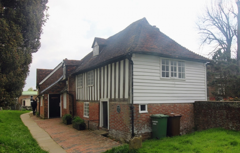
School. C16. Timber framed and clad in red brick on ground floor with exposed close studding and plaster infilling on first floor. Plain tiled roof, hipped to right and half hipped to left. Stack behind ridge to rear, to right of centre. 2 gabled dormers, one in centre and one lower to left. 2 storeys and attics, with single storey and attic to left. Irregular fenestration of iron casement windows with 3 on ground floor and two above to right. Lean-to to front to left with catslide beyond to left and 4-bay C19 extension with large hexagonal lozenge lattice glazing in double pointed-arched casement window surrounds. Gable to left. Boarded doors to extreme right and in right re- entrant face of projecting catslide.
Listing NGR: TQ7772336142
External links are from the relevant listing authority and, where applicable, Wikidata. Wikidata IDs may be related buildings as well as this specific building. If you want to add or update a link, you will need to do so by editing the Wikidata entry.


Other nearby listed buildings