Latitude: 51.7834 / 51°47'0"N
Longitude: 0.1479 / 0°8'52"E
OS Eastings: 548260
OS Northings: 211594
OS Grid: TL482115
Mapcode National: GBR LDK.27F
Mapcode Global: VHHM7.JF2Q
Plus Code: 9F32Q4MX+85
Entry Name: 2, 4 and 6, Churchgate Street
Listing Date: 5 July 1950
Last Amended: 19 June 1981
Grade: II
Source: Historic England
Source ID: 1337026
English Heritage Legacy ID: 119440
ID on this website: 101337026
Location: Churchgate Street, Harlow, Essex, CM17
County: Essex
District: Harlow
Electoral Ward/Division: Old Harlow
Parish: Non Civil Parish
Built-Up Area: Harlow
Traditional County: Essex
Lieutenancy Area (Ceremonial County): Essex
Church of England Parish: Harlow St Mary and St Hugh with St John the Baptist
Church of England Diocese: Chelmsford
Tagged with: Building
1.
5216
TL 4811 NW
7/5
5.7.50
CHURCHGATE STREET
(west side)
Nos 2, 4 and 6
(formerly listed as block of 3 cottages opposite Meadhams)
II
GV
2.
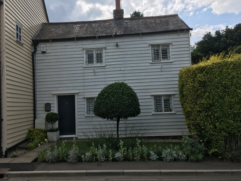
Early C19 house. Timber framed and weatherboarded, of rectangular plan.
Two stock brick chimney stacks, one each end, roof ridged and gabled with
eaves - peg-tiled. Small paned sashes on first storey in exposed boxes,
one matching sash on ground storey at south. Door of 6 fielded panels with
broken pediment on reeded half columns with no fanlight. A matching door
north of last one, and a large square former shop window with small panes;
and a name board above it. A 2 storey extension to the north with slated
roof and central red brick chimney stack. Four leaded casements, 2 over
2 and a plain door at the south in a case. Walls of painted weatherboards.
Listing NGR: TL4826011594
External links are from the relevant listing authority and, where applicable, Wikidata. Wikidata IDs may be related buildings as well as this specific building. If you want to add or update a link, you will need to do so by editing the Wikidata entry.


Other nearby listed buildings