Latitude: 51.4357 / 51°26'8"N
Longitude: -0.0942 / 0°5'39"W
OS Eastings: 532566
OS Northings: 172469
OS Grid: TQ325724
Mapcode National: GBR GS.BWZ
Mapcode Global: VHGRD.B51Q
Plus Code: 9C3XCWP4+78
Entry Name: The Rosendale Public House
Listing Date: 16 May 1975
Grade: II
Source: Historic England
Source ID: 1338540
English Heritage Legacy ID: 204596
Also known as: The Rosendale
Rosendale
ID on this website: 101338540
Location: West Dulwich, Lambeth, London, SE21
County: London
District: Lambeth
Electoral Ward/Division: Gipsy Hill
Parish: Non Civil Parish
Built-Up Area: Lambeth
Traditional County: Surrey
Lieutenancy Area (Ceremonial County): Greater London
Church of England Parish: West Dulwich Emmanuel
Church of England Diocese: Southwark
Tagged with: Pub
ROSENDALE ROAD SE21 1. (west side) 5023 The Rosendale Public House TQ 3272 32/813 16.5.75
II
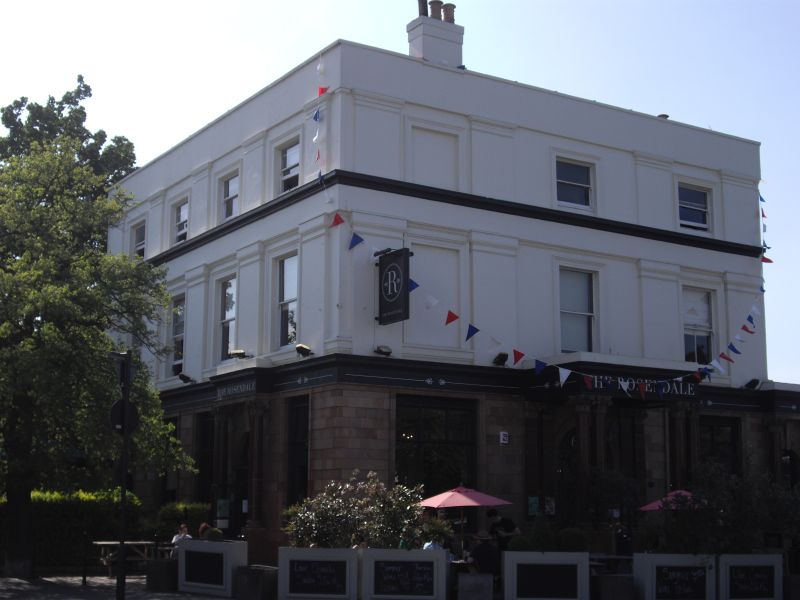
2. Mid C19 front of three storeys, three windows, with ground floor rebuilt in late C19 in architectural faience. Stock brick core. Front upper part stuccoed with pilasters and entablature on first floor, top parapet. Sash windows in moulded architraves. Banded rusticated faience ground floor has central prostyle porch with paired composite columns. Round moulded architrave, with moulded spandrels, above door. Smaller similar porch at right. Four bay return to Park Hall Road in similar style.
Listing NGR: TQ3256672469
External links are from the relevant listing authority and, where applicable, Wikidata. Wikidata IDs may be related buildings as well as this specific building. If you want to add or update a link, you will need to do so by editing the Wikidata entry.


Other nearby listed buildings