Latitude: 51.134 / 51°8'2"N
Longitude: 0.4187 / 0°25'7"E
OS Eastings: 569323
OS Northings: 139971
OS Grid: TQ693399
Mapcode National: GBR NR9.YGJ
Mapcode Global: VHJMY.6RQK
Plus Code: 9F324CM9+HF
Entry Name: Outbuildings, Walls and Rear Courtyard North of Sprivers
Listing Date: 10 October 1989
Grade: II
Source: Historic England
Source ID: 1338761
English Heritage Legacy ID: 169899
ID on this website: 101338761
Location: Hazel Street, Tunbridge Wells, Kent, TN12
County: Kent
District: Tunbridge Wells
Civil Parish: Horsmonden
Traditional County: Kent
Lieutenancy Area (Ceremonial County): Kent
Church of England Parish: Horsmonden St Margaret
Church of England Diocese: Rochester
Tagged with: Appendage
HORSMONDEN LAMBERHURST ROAD TQ 63 NE (west side) 3/63 Outbuildings, walls & rear courtyard north of Sprivers GV II
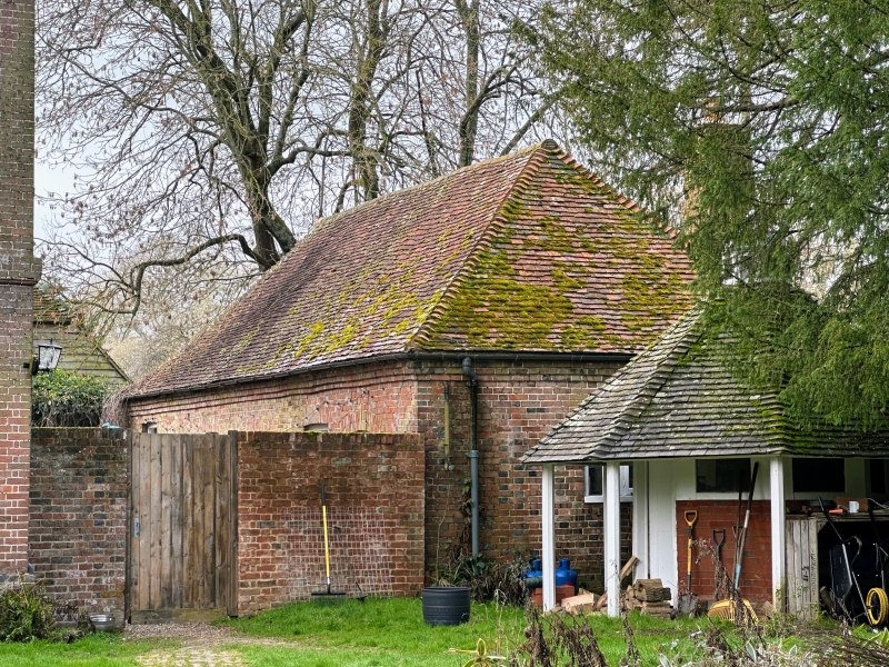
Outbuildings walls and courtyard. Circa 1750 and earlier. Red brick walls and storehouse with timber framed and weather boarded block; plain tiled roofs. Brick building, used as granary, honey house with apple loft over and bakehouse/brewery. Single storey on plinth with brick corbelled eaves cornice to hipped roof with stacks to rear left and to rear right. Three segmentally headed wooden casements, the centre with lattice work shutters, and 4 boarded doors. Hipped rear wing, the base in earlier English bond brickwork. Interior: end right section still with large sink and pump for brewing or washing purposes. Attached to left and enclosing a small garden area are red and blue chequered brick walls about 7 feet high in garden wall bond with boarded gateways linking to weather boarded building of 1 storey with half-hipped roof and stack to rear in red brick section. Two boarded doors, and simple window openings on returns. Interior: brick paviour floor; end bays lofted over; clasped purlin roof. Red brick wall, about 7 feet high extending to left (south) about 30 metres parallel to that extending southwards from the main house. Courtyard between House and outbuildings paved with brick.
Listing NGR: TQ6932339971
External links are from the relevant listing authority and, where applicable, Wikidata. Wikidata IDs may be related buildings as well as this specific building. If you want to add or update a link, you will need to do so by editing the Wikidata entry.


Other nearby listed buildings