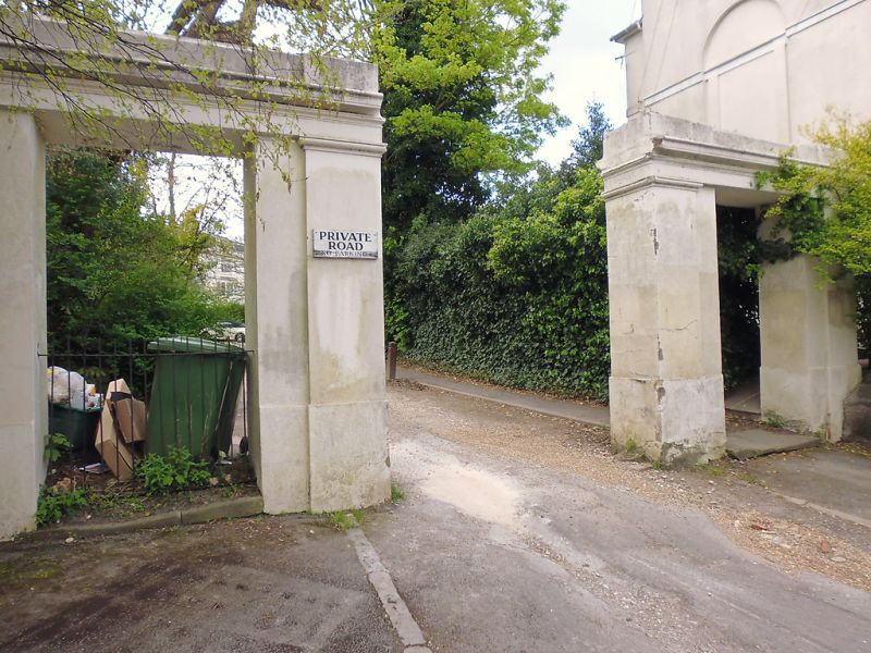
Latitude: 51.1287 / 51°7'43"N
Longitude: 0.2681 / 0°16'5"E
OS Eastings: 558802
OS Northings: 139048
OS Grid: TQ588390
Mapcode National: GBR MPZ.2ML
Mapcode Global: VHHQD.LWLM
Plus Code: 9F3247H9+F6
Entry Name: Entrance to Grove Hill Gardens
Listing Date: 7 June 1974
Grade: II
Source: Historic England
Source ID: 1338784
English Heritage Legacy ID: 168003
ID on this website: 101338784
Location: Royal Tunbridge Wells, Tunbridge Wells, Kent, TN1
County: Kent
District: Tunbridge Wells
Electoral Ward/Division: Pantiles and St Mark's
Parish: Non Civil Parish
Built-Up Area: Royal Tunbridge Wells
Traditional County: Kent
Lieutenancy Area (Ceremonial County): Kent
Church of England Parish: Tunbridge Wells Holy Trinity with Christ Church
Church of England Diocese: Rochester
Tagged with: Arch Architectural structure
GROVE HILL GARDENS 1. 1746 Entrance to Grove Hill Gardens TQ 5839 SE 7/200 II 2. Mid C19, A stuccoed arch with a central carriage entrance flanked by 2 pedestrian arches. 2 square pilasters and an entablature over.
Listing NGR: TQ5880239048
External links are from the relevant listing authority and, where applicable, Wikidata. Wikidata IDs may be related buildings as well as this specific building. If you want to add or update a link, you will need to do so by editing the Wikidata entry.


Other nearby listed buildings