Approximate Location Map
Large Map »
Latitude: 51.1326 / 51°7'57"N
Longitude: 0.2598 / 0°15'35"E
OS Eastings: 558206
OS Northings: 139469
OS Grid: TQ582394
Mapcode National: GBR MPS.SLW
Mapcode Global: VHHQD.GS5L
Plus Code: 9F3247M5+3W
Entry Name: Ashton Lodge
Listing Date: 20 May 1952
Grade: II
Source: Historic England
Source ID: 1338813
English Heritage Legacy ID: 168048
ID on this website: 101338813
Location: Royal Tunbridge Wells, Tunbridge Wells, Kent, TN1
County: Kent
District: Tunbridge Wells
Electoral Ward/Division: Culverden
Parish: Non Civil Parish
Built-Up Area: Royal Tunbridge Wells
Traditional County: Kent
Lieutenancy Area (Ceremonial County): Kent
Church of England Parish: Tunbridge Wells Holy Trinity with Christ Church
Church of England Diocese: Rochester
Tagged with: Gatehouse
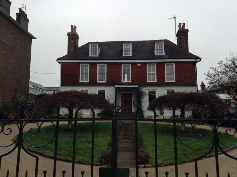
LONDON ROAD
1.
1746
No 69
(Ashton Lodge)
TQ 5839 SW 2/249 20.5.52
II GV
2.
An C18 house altered. 2 storeys and attics. Ground floor stuccoed, above tile-hung.
Hipped tiled roof and wooden eaves cornice. 5 sashes with the wide squares of
the glazing bars intact. Wooden trellis-work porch and steps to street level.
Nos 69 to 73 (consec) form a group.
Listing NGR: TQ5821439470
External links are from the relevant listing authority and, where applicable, Wikidata. Wikidata IDs may be related buildings as well as this specific building. If you want to add or update a link, you will need to do so by editing the Wikidata entry.


Other nearby listed buildings
