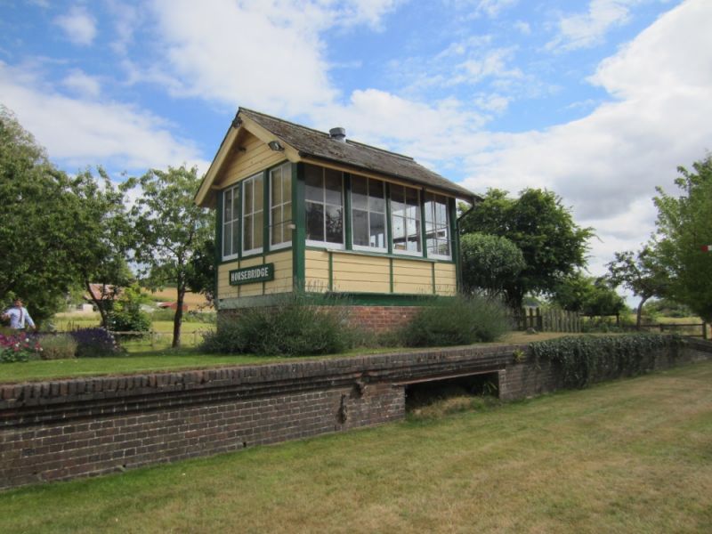
Latitude: 51.0716 / 51°4'17"N
Longitude: -1.5104 / 1°30'37"W
OS Eastings: 434396
OS Northings: 130364
OS Grid: SU343303
Mapcode National: GBR 748.NYF
Mapcode Global: FRA 76Q9.3CH
Plus Code: 9C3W3FCQ+JR
Entry Name: Horsebridge Station
Listing Date: 7 February 1986
Grade: II
Source: Historic England
Source ID: 1339080
English Heritage Legacy ID: 140692
ID on this website: 101339080
Location: Horsebridge, Test Valley, Hampshire, SO20
County: Hampshire
District: Test Valley
Civil Parish: Houghton
Traditional County: Hampshire
Lieutenancy Area (Ceremonial County): Hampshire
Church of England Parish: Houghton All Saints
Church of England Diocese: Winchester
Tagged with: Railway station
HOUGHTON HORSEBRIDGE SU 33 W 4/50 Horsebridge Station II Station building. 1865, for London and South Western Railway. Brick with stone dressings, with later slate cladding, timber awnings, slate roof, 2 storey, 2 bay house with single storey part at one end. On station side of this and far bay of house is a one bay deep single storey flat roofed wing with glazed infill between and in front, stretching right across, 3 wide bay canopy, over part of brick edged platform. Railway front has double door under segmental head in end of left wing, and 3-light casement in right wing. Gas lamp hung between,with infill behind glazed on rendered walls with half-glazed double doors to left of centre. Canopy on 4 cast-iron columns with brackets at top to main beams, having spandrels infilled with foliage. Around canopy freework awning. On side of right wing urinal. Left end has segmental head 3-light casements on both floors of house part with rubbed brick heads, with stack on side wall above front wing and similar window in wing.
Listing NGR: SU3372133375
External links are from the relevant listing authority and, where applicable, Wikidata. Wikidata IDs may be related buildings as well as this specific building. If you want to add or update a link, you will need to do so by editing the Wikidata entry.


Other nearby listed buildings