Latitude: 51.702 / 51°42'7"N
Longitude: -2.1883 / 2°11'18"W
OS Eastings: 387080
OS Northings: 200380
OS Grid: SO870003
Mapcode National: GBR 1N5.CJR
Mapcode Global: VH955.0HZ2
Plus Code: 9C3VPR26+RM
Entry Name: The Shard
Listing Date: 24 March 1988
Grade: II
Source: Historic England
Source ID: 1340459
English Heritage Legacy ID: 133031
ID on this website: 101340459
Location: Bubblewell, Stroud, Gloucestershire, GL6
County: Gloucestershire
District: Stroud
Civil Parish: Minchinhampton
Built-Up Area: Minchinhampton
Traditional County: Gloucestershire
Lieutenancy Area (Ceremonial County): Gloucestershire
Church of England Parish: Minchinhampton with Box
Church of England Diocese: Gloucester
Tagged with: Architectural structure
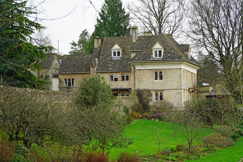
SO 8600-8700 MINCHINHAMPTON FORWOOD
19/241 The Shard
II
Detached house. Late C17; altered and enlarged 1923 by Thomas
Falconer. Random rubble and coursed limestone; rubble and ashlar
chimneys; stone slate roof. Two-storey with attic; 2 rear wings.
Front: 4-window fenestration, all 2-light recessed chamfered
mullioned casements, 2 to right being C20 replacements. Continuous
dripmould to ground floor. C20 central doorway with flat stone
porch hood on shaped brackets, double C20 panelled doors. Deep
plastered eaves coving to hipped roof (this rebuilt in 1923,
probably replacing gabled roof). Central gabled dormer with leaded
casement. Gable end of one rear wing set back to right with C20
flat roofed addition. East end: mullioned fenestration to C20
rear wing with oval in gable. West end: single-window
fenestration as to front, hoodmould to ground floor extended round
from front. Projecting rear chimney gable, shaft having moulded
cap, partially obscured by C20 rear wing containing entrance hall
and staircase. Interior not inspected but entirely rebuilt in
1923.
(D. Verey, Gloucestershire: The Cotswolds, 1979)
Listing NGR: SO8708000380
External links are from the relevant listing authority and, where applicable, Wikidata. Wikidata IDs may be related buildings as well as this specific building. If you want to add or update a link, you will need to do so by editing the Wikidata entry.


Other nearby listed buildings