Latitude: 51.6748 / 51°40'29"N
Longitude: -1.9288 / 1°55'43"W
OS Eastings: 405022
OS Northings: 197341
OS Grid: SU050973
Mapcode National: GBR 3RC.Z28
Mapcode Global: VHB2Y.J56F
Plus Code: 9C3WM3FC+WF
Entry Name: Two Unidentified Monuments, About 6 Metres South East of South East Corner of Chancel in Churchyard of Church of All Hallows
Listing Date: 27 February 1986
Grade: II
Source: Historic England
Source ID: 1340979
English Heritage Legacy ID: 129532
ID on this website: 101340979
Location: All Hallows' Church, South Cerney, Cotswold, Gloucestershire, GL7
County: Gloucestershire
District: Cotswold
Civil Parish: South Cerney
Built-Up Area: South Cerney
Traditional County: Gloucestershire
Lieutenancy Area (Ceremonial County): Gloucestershire
Church of England Parish: South Cerney All Hallows
Church of England Diocese: Gloucester
Tagged with: Monument
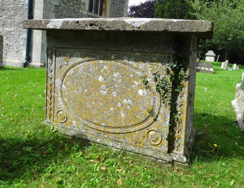
SOUTH CERNEY CHURCH LANE SU 0497-0597 (north side) 14/233 Two Unidentified Monuments, about 6m south-east of south-east corner of chancel in churchyard of Church of All Hallows GV II Two chest tombs. To north, mid/late C18; to south, early C18. Limestone. To north, slight tent top. Moulded plinth and capping, decorative frieze, slightly indented corners. Plain ends with carved returns, slightly fielded oval side panels. To south, flat top. Moulded capping, no plinth visible. Sides divided into 2 plain recessed inscription panels.
Listing NGR: SU0502297341
External links are from the relevant listing authority and, where applicable, Wikidata. Wikidata IDs may be related buildings as well as this specific building. If you want to add or update a link, you will need to do so by editing the Wikidata entry.


Other nearby listed buildings