Latitude: 51.7188 / 51°43'7"N
Longitude: -1.8966 / 1°53'47"W
OS Eastings: 407242
OS Northings: 202238
OS Grid: SP072022
Mapcode National: GBR 3R1.1BY
Mapcode Global: VHB2S.22Q5
Plus Code: 9C3WP493+G9
Entry Name: 29, Ampney Crucis Village
Listing Date: 17 June 1986
Grade: II
Source: Historic England
Source ID: 1341000
English Heritage Legacy ID: 129657
ID on this website: 101341000
Location: Hilcot End, Cotswold, Gloucestershire, GL7
County: Gloucestershire
District: Cotswold
Civil Parish: Ampney Crucis
Built-Up Area: Ampney Crucis
Traditional County: Gloucestershire
Lieutenancy Area (Ceremonial County): Gloucestershire
Church of England Parish: Ampney Crucis The Holy Rood
Church of England Diocese: Gloucester
Tagged with: Building
SP 0602-0702 AMPNEY CRUCIS AMPNEY CRUCIS VILLAGE (south side)
11/35 No 29 Ampney Crucis
GV II
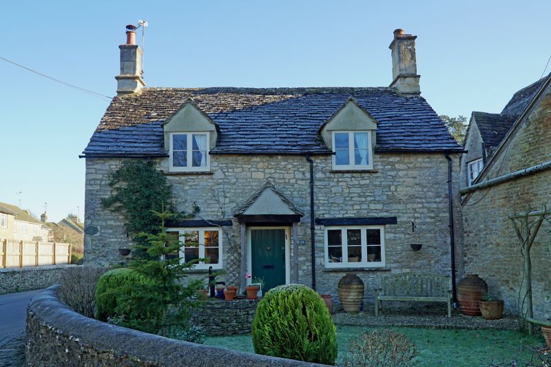
Detached cottage, used as village stores and post office. Late C17/early C18. Rubble stone, stone slate roof, stone end stacks with offset and cornice. Single main range of single storey and attic, with single storey rear extension with flat roof. Two gabled dormers through eaves with paired casements. Ground floor has 3-light wood casements with timber lintel flanking central C20 plank door with timber lintel and gabled hood on struts. Included for group value.
Listing NGR: SP0724202238
External links are from the relevant listing authority and, where applicable, Wikidata. Wikidata IDs may be related buildings as well as this specific building. If you want to add or update a link, you will need to do so by editing the Wikidata entry.


Other nearby listed buildings