Latitude: 51.9102 / 51°54'36"N
Longitude: -1.8286 / 1°49'43"W
OS Eastings: 411885
OS Northings: 223527
OS Grid: SP118235
Mapcode National: GBR 4Q4.6HD
Mapcode Global: VHB1V.8840
Plus Code: 9C3WW56C+3H
Entry Name: Longford House and Attached Outbuildings
Listing Date: 25 August 1960
Last Amended: 16 July 1986
Grade: II
Source: Historic England
Source ID: 1341052
English Heritage Legacy ID: 129969
ID on this website: 101341052
Location: Naunton, Cotswold, Gloucestershire, GL54
County: Gloucestershire
District: Cotswold
Civil Parish: Naunton
Built-Up Area: Naunton
Traditional County: Gloucestershire
Lieutenancy Area (Ceremonial County): Gloucestershire
Church of England Parish: Naunton St Andrew
Church of England Diocese: Gloucester
Tagged with: Architectural structure
NAUNTON VILLAGE STREET SP 1123 (n side) 8/85 Longford House and attached outbuildings (previously listed 25.8.60 as Longford House )
GV II
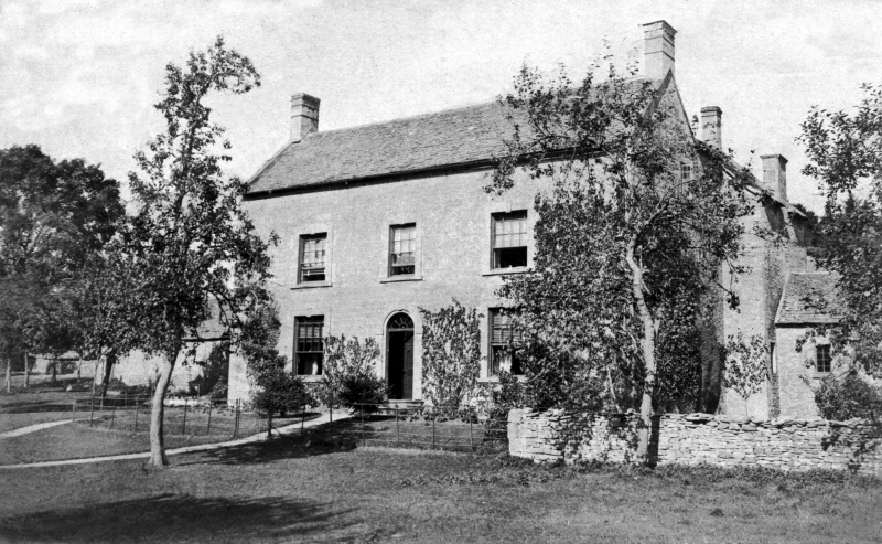
c.1800, farmhouse. Coursed rubble with Cotswold stone roof, coped ranges and end chimneys. 2 storeys. 3 windows, glazing bar sashes, outer ones with 16 panes, in the raised surrounds with keys. Central arched doorway with traceried fanlight and 6-panel door. Set some way back from road. In front to south are low garden walls with axial gate piers capped by discus-shapes. 2 gabled wings to rear and attached lower contemporary outhouses to east side in similar materials.
Listing NGR: SP1188523527
External links are from the relevant listing authority and, where applicable, Wikidata. Wikidata IDs may be related buildings as well as this specific building. If you want to add or update a link, you will need to do so by editing the Wikidata entry.


Other nearby listed buildings