Latitude: 51.9212 / 51°55'16"N
Longitude: -1.8644 / 1°51'51"W
OS Eastings: 409419
OS Northings: 224753
OS Grid: SP094247
Mapcode National: GBR 3NK.HFV
Mapcode Global: VHB1M.MZQ2
Plus Code: 9C3WW4CP+F6
Entry Name: Tudor House Guiting Power Amenity Trust
Listing Date: 25 August 1960
Last Amended: 11 January 1985
Grade: II
Source: Historic England
Source ID: 1341228
English Heritage Legacy ID: 128733
ID on this website: 101341228
Location: Guiting Power, Cotswold, Gloucestershire, GL54
County: Gloucestershire
District: Cotswold
Civil Parish: Guiting Power
Traditional County: Gloucestershire
Lieutenancy Area (Ceremonial County): Gloucestershire
Church of England Parish: Guiting Power St Michael
Church of England Diocese: Gloucester
Tagged with: Architectural structure
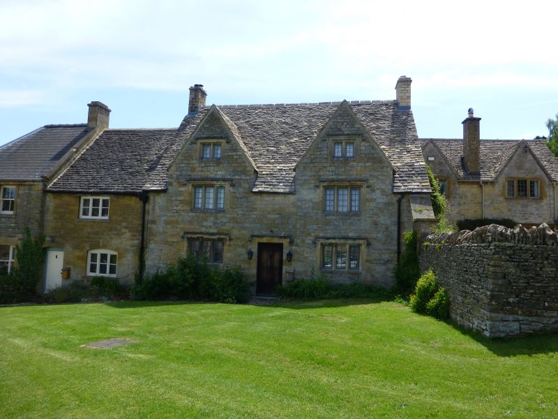
GUTTING POWER THE MARKET SQUARE SP 0924 (south side) 11/95 Tudor House (formerly listed as House immediately east of Reading Room) 25.8.60 Guiting Power Amenity Trust GV II House in row. Late C17-C18, virtually rebuilt as before re-using stone. C20. Coursed squared and dressed limestone, limestone slate roof, limestone stacks. Rectangular plan, C20 interior plan. Symmetrical facade. 2 storeys and attic lit by 2 Cotswold dormers with 2-light stone-mullioned casements with leaded panes and stopped hoods. Stopped hood over central plank door. Gable end stacks. Interior not inspected. Building occupies a prominent position in Market Square at centre of village.
Listing NGR: SP0941924753
External links are from the relevant listing authority and, where applicable, Wikidata. Wikidata IDs may be related buildings as well as this specific building. If you want to add or update a link, you will need to do so by editing the Wikidata entry.


Other nearby listed buildings