Approximate Location Map
Large Map »
Latitude: 51.4423 / 51°26'32"N
Longitude: 0.3756 / 0°22'32"E
OS Eastings: 565198
OS Northings: 174160
OS Grid: TQ651741
Mapcode National: GBR NMK.KSV
Mapcode Global: VHJLK.G0GM
Plus Code: 9F32C9RG+W7
Entry Name: 14, Milton Place
Listing Date: 3 July 1975
Grade: II
Source: Historic England
Source ID: 1341482
English Heritage Legacy ID: 356384
ID on this website: 101341482
Location: Milton, Gravesham, Kent, DA12
County: Kent
District: Gravesham
Electoral Ward/Division: Riverside
Parish: Non Civil Parish
Built-Up Area: Gravesend
Traditional County: Kent
Lieutenancy Area (Ceremonial County): Kent
Church of England Parish: Gravesend St George
Church of England Diocese: Rochester
Tagged with: Building
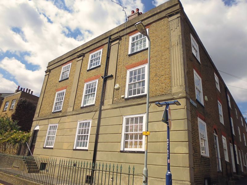
1.
5277 MILTON PLACE
(North West Side)
No 14
TQ 6574 SW 2/84
II GV
2.
Early to mid C19. 3 storeys brown brick. Parapet. 4 cemented fluted pilasters
and rusticated ground floor. 3 altered sashes. Left side round-headed doorcase.
Forms a group with Nos 1 to 8 (consec) East Terrace.
Listing NGR: TQ6519874160
External links are from the relevant listing authority and, where applicable, Wikidata. Wikidata IDs may be related buildings as well as this specific building. If you want to add or update a link, you will need to do so by editing the Wikidata entry.


Other nearby listed buildings
