Approximate Location Map
Large Map »
Latitude: 51.3893 / 51°23'21"N
Longitude: 1.3886 / 1°23'18"E
OS Eastings: 635854
OS Northings: 171030
OS Grid: TR358710
Mapcode National: GBR WZS.XK4
Mapcode Global: VHMCP.0BYV
Plus Code: 9F3399QQ+PC
Entry Name: Clifton Arms Public House
Listing Date: 22 February 1973
Grade: II
Source: Historic England
Source ID: 1341530
English Heritage Legacy ID: 356523
ID on this website: 101341530
Location: Margate, Thanet, Kent, CT9
County: Kent
District: Thanet
Electoral Ward/Division: Cliftonville West
Parish: Non Civil Parish
Built-Up Area: Margate
Traditional County: Kent
Lieutenancy Area (Ceremonial County): Kent
Tagged with: Pub
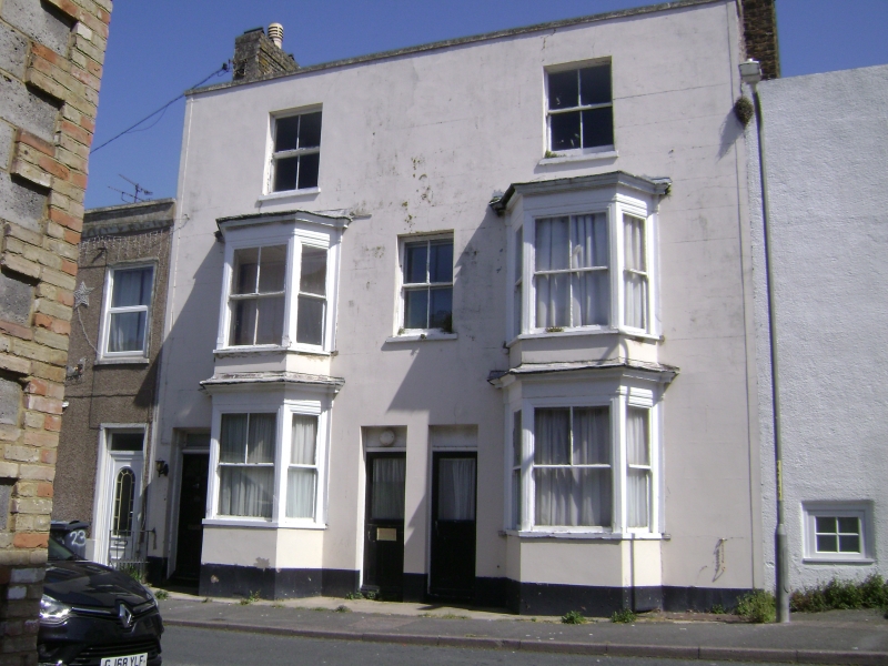
1.
1380 CLIFTON STREET
No 25
(Clifton Arms
Public House)
TR 3571 SE 3/136
II GV
2.
Mid C19. 3 storeys stuccoed. Stone coping. 2:3:2 windows. 2 3-light canted
bays through ground and 1st floors.
No 25 and Nos 27 to 39 (odd) form a group
Listing NGR: TR3585471030
External links are from the relevant listing authority and, where applicable, Wikidata. Wikidata IDs may be related buildings as well as this specific building. If you want to add or update a link, you will need to do so by editing the Wikidata entry.


Other nearby listed buildings
