Approximate Location Map
Large Map »
Latitude: 51.3862 / 51°23'10"N
Longitude: 1.3825 / 1°22'56"E
OS Eastings: 635443
OS Northings: 170669
OS Grid: TR354706
Mapcode National: GBR WZZ.2B1
Mapcode Global: VHLG6.XF66
Plus Code: 9F3399PJ+FX
Entry Name: 40, Hawley Square
Listing Date: 22 February 1973
Grade: II
Source: Historic England
Source ID: 1341539
English Heritage Legacy ID: 356566
ID on this website: 101341539
Location: Margate, Thanet, Kent, CT9
County: Kent
District: Thanet
Electoral Ward/Division: Margate Central
Parish: Non Civil Parish
Built-Up Area: Margate
Traditional County: Kent
Lieutenancy Area (Ceremonial County): Kent
Tagged with: Building
HAWLEY SQUARE
1.
1380
(West Side)
No 40
TR 3570 NW 1/175
II GV
2.
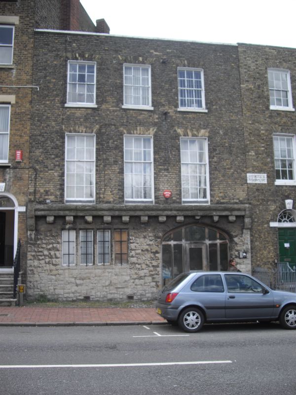
Early C19. 3 storeys brown brick. Stone coping. Ground floor has been refaced
in ashlar. 3 sashes with glazing bars intact.
Nos 39 to 51 (consec) form a group
Listing NGR: TR3544370669
External links are from the relevant listing authority and, where applicable, Wikidata. Wikidata IDs may be related buildings as well as this specific building. If you want to add or update a link, you will need to do so by editing the Wikidata entry.


Other nearby listed buildings
