Latitude: 52.4856 / 52°29'8"N
Longitude: -1.9047 / 1°54'17"W
OS Eastings: 406565
OS Northings: 287520
OS Grid: SP065875
Mapcode National: GBR 5Z6.BW
Mapcode Global: VH9YW.XSXF
Plus Code: 9C4WF3PW+64
Entry Name: 12, 13 and 14, St Paul's Square B3
Listing Date: 21 January 1970
Last Amended: 8 July 1982
Grade: II
Source: Historic England
Source ID: 1343135
English Heritage Legacy ID: 217570
ID on this website: 101343135
Location: Birmingham, West Midlands, B3
County: Birmingham
Parish: Non Civil Parish
Built-Up Area: Birmingham
Traditional County: Warwickshire
Lieutenancy Area (Ceremonial County): West Midlands
Church of England Parish: Birmingham St Paul
Church of England Diocese: Birmingham
Tagged with: Building
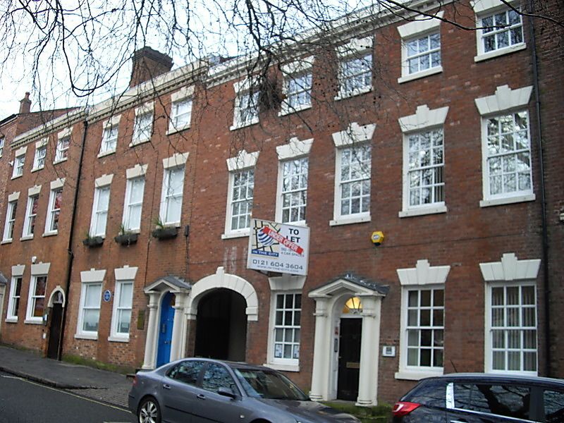
ST PAUL'S SQUARE 1. Hockley B3 Nos 12, 13 and 14 (formerly listed under City Centre) SP 0687 NE 25/11 21.1.70 II GV 2. Circa 1780 unmaltered range of town houses on east side of the square. Three storeys red brick. No 12 a 5 bay front the other 2 of 3 bays each stepped slightly higher with slope. Painted stone plinths and small modillion brackets to moulded cornices with blocking courses. Revealed glazing bar sash windows with painted stone sills and flat arches with grooved voussoirs and keystones. Three identical wooden doorcases with engaged Luscan columns, sections of entablature and open pediments over fanlight. Elleptical, voussoired, carriage arch to centre of range. The houses are the least altered sequence in the square.
Listing NGR: SP0656587525
External links are from the relevant listing authority and, where applicable, Wikidata. Wikidata IDs may be related buildings as well as this specific building. If you want to add or update a link, you will need to do so by editing the Wikidata entry.


Other nearby listed buildings