Latitude: 52.4051 / 52°24'18"N
Longitude: -1.7084 / 1°42'30"W
OS Eastings: 419934
OS Northings: 278609
OS Grid: SP199786
Mapcode National: GBR 4J9.0XH
Mapcode Global: VHBWV.BTP3
Plus Code: 9C4WC74R+3J
Entry Name: Gate Piers at the Firs
Listing Date: 22 July 1976
Grade: II
Source: Historic England
Source ID: 1343231
English Heritage Legacy ID: 218056
ID on this website: 101343231
Location: Eastcote, Solihull, West Midlands, B92
County: Solihull
Civil Parish: Barston
Traditional County: Warwickshire
Lieutenancy Area (Ceremonial County): West Midlands
Church of England Parish: Barston
Church of England Diocese: Birmingham
Tagged with: Gatepost
1.
5108
SP 17 NE
3/173
BARSTON
BARSTON LANE
(North Side)
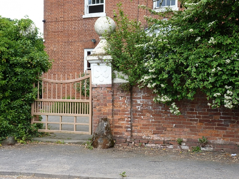
Gate Piers at The Firs
II
GV
2.
Pair of C18 red brick gate piers with ashlar cornices and ball finials. Included
for group value.
The Firs, Barn and Gate Piers at The Firs form a group.
Listing NGR: SP1993478609
External links are from the relevant listing authority and, where applicable, Wikidata. Wikidata IDs may be related buildings as well as this specific building. If you want to add or update a link, you will need to do so by editing the Wikidata entry.


Other nearby listed buildings