Approximate Location Map
Large Map »
Latitude: 52.1942 / 52°11'39"N
Longitude: 0.1374 / 0°8'14"E
OS Eastings: 546191
OS Northings: 257260
OS Grid: TL461572
Mapcode National: GBR L7H.KJK
Mapcode Global: VHHK9.B3HR
Plus Code: 9F4254VP+MX
Entry Name: The Railway Station
Listing Date: 10 May 1962
Grade: II
Source: Historic England
Source ID: 1343683
English Heritage Legacy ID: 47778
Also known as: Cambridge station
CBG
ID on this website: 101343683
Location: Newtown, Cambridge, Cambridgeshire, CB1
County: Cambridgeshire
District: Cambridge
Electoral Ward/Division: Trumpington
Parish: Non Civil Parish
Built-Up Area: Cambridge
Traditional County: Cambridgeshire
Lieutenancy Area (Ceremonial County): Cambridgeshire
Church of England Parish: Cambridge St Paul
Church of England Diocese: Ely
Tagged with: Railway station
STATION ROAD
1.
942
The Railway
Station
TL 45 NE 2l/222A 10.5.62.
II
2.
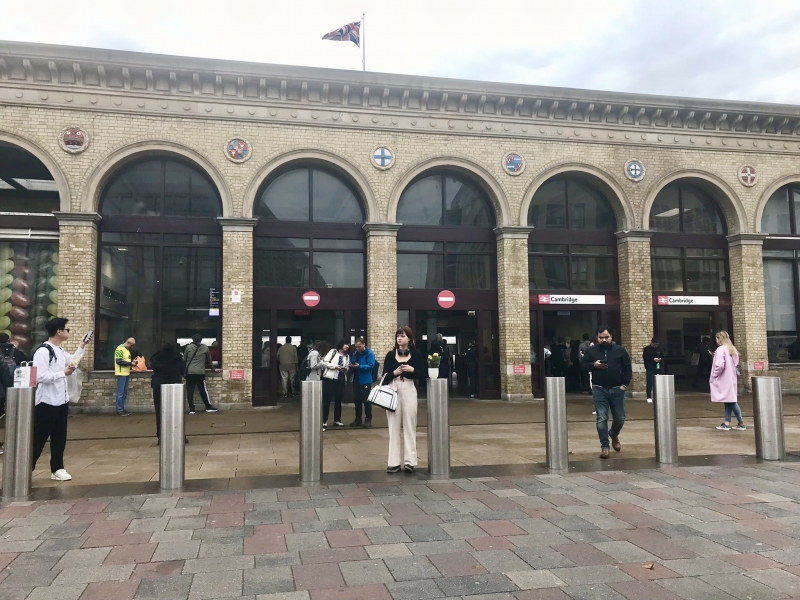
1845. Architect Sancton Wood. White gault brick. Stone bracket cornice.
15 tall round-headed arches, originally all open but of which only the 5
northernmost ones now are. The centre 6 arches have been completely enclosed
with semi-circular fanlights in the heads, and the 4 southernmost arches
partly enclosed with open heads. Stone roundels in the spandrels of the
arches with coats of arms of the colleges, the City and various City officials
of the timer The original design of the station was materially altered
in 1863. (Real 85).
Listing NGR: TL4619157260
External links are from the relevant listing authority and, where applicable, Wikidata. Wikidata IDs may be related buildings as well as this specific building. If you want to add or update a link, you will need to do so by editing the Wikidata entry.


Other nearby listed buildings
