Approximate Location Map
Large Map »
Latitude: 51.3122 / 51°18'43"N
Longitude: 0.8893 / 0°53'21"E
OS Eastings: 601458
OS Northings: 160970
OS Grid: TR014609
Mapcode National: GBR SW3.PN7
Mapcode Global: VHKJW.C8GY
Plus Code: 9F328V6Q+VP
Entry Name: Wall and Gate Piers Enclosing Garden to West of Delbridge House on Its North Side
Listing Date: 3 August 1972
Grade: II
Source: Historic England
Source ID: 1343836
English Heritage Legacy ID: 175988
ID on this website: 101343836
Location: Preston, Swale, Kent, ME13
County: Kent
District: Swale
Civil Parish: Faversham
Built-Up Area: Faversham
Traditional County: Kent
Lieutenancy Area (Ceremonial County): Kent
Tagged with: Wall
PRESTON STREET
1.
1103 (West Side)
--------------
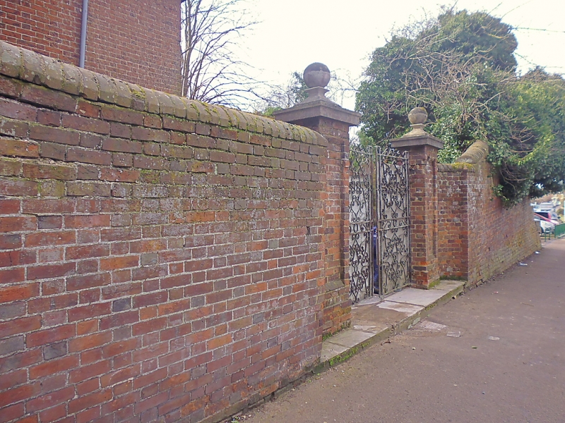
Wall and gate piers enclosing
garden to West of Delbridge
House on its North Side
TR 0l6O 12/54A
II
2.
C18, Wall of red brick with red brick coping. Red brick panelled gate
piers with rendered capping and ball finials.
Listing NGR: TR0145960970
External links are from the relevant listing authority and, where applicable, Wikidata. Wikidata IDs may be related buildings as well as this specific building. If you want to add or update a link, you will need to do so by editing the Wikidata entry.


Other nearby listed buildings
