Latitude: 50.9503 / 50°57'1"N
Longitude: 0.9055 / 0°54'19"E
OS Eastings: 604179
OS Northings: 120781
OS Grid: TR041207
Mapcode National: GBR T0L.7RW
Mapcode Global: FRA D6SL.NKP
Plus Code: 9F22XW24+46
Entry Name: 4 and 5, Park Street
Listing Date: 30 January 1973
Grade: II
Source: Historic England
Source ID: 1344121
English Heritage Legacy ID: 175242
ID on this website: 101344121
Location: Lydd, Folkestone and Hythe, Kent, TN29
County: Kent
District: Folkestone and Hythe
Civil Parish: Lydd
Built-Up Area: Lydd
Traditional County: Kent
Lieutenancy Area (Ceremonial County): Kent
Tagged with: Building
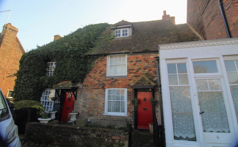
PARK STREET 1. 1355 (South-East Side) Nos 4 and 5 TR 0420 NW 1/36 II GV 2. A pair of cottages, C18 or earlier. 2 storeys. Ground floor red brick and cobbles. Above tile-hung. Tiled roof. 3 sashes, with glazing bars intact except in one window. The rear elevation has 3 gables 2 of which are weatherboarded and the roof slopes to the ground floor. Nos 3 to 5 (consec) form a group.
Listing NGR: TR0418420780
External links are from the relevant listing authority and, where applicable, Wikidata. Wikidata IDs may be related buildings as well as this specific building. If you want to add or update a link, you will need to do so by editing the Wikidata entry.


Other nearby listed buildings