Latitude: 51.0804 / 51°4'49"N
Longitude: 1.1832 / 1°10'59"E
OS Eastings: 623053
OS Northings: 136050
OS Grid: TR230360
Mapcode National: GBR W21.CXJ
Mapcode Global: FRA F6C8.GR3
Plus Code: 9F3335JM+57
Entry Name: 20 and 22, the Old High Street
Listing Date: 11 March 1975
Grade: II
Source: Historic England
Source ID: 1344140
English Heritage Legacy ID: 175342
ID on this website: 101344140
Location: Folkestone, Folkestone and Hythe, Kent, CT20
County: Kent
District: Folkestone and Hythe
Civil Parish: Folkestone
Built-Up Area: Folkestone
Traditional County: Kent
Lieutenancy Area (Ceremonial County): Kent
Tagged with: Building
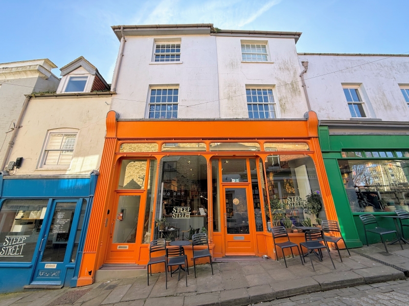
1. 5281 THE OLD HIGH STREET (South Side) FOLKESTONE Nos 20 and 22 TR 2336 SW 3/137 II GV 2. Cl8. 3 storeys stuccoed. Hipped tiled roof. 2 sashes with glazing bars intact,, Late Cl9 shopfront with wide fascia.
Nos 20 to 30 (even) form a group.
Listing NGR: TR2304636047
External links are from the relevant listing authority and, where applicable, Wikidata. Wikidata IDs may be related buildings as well as this specific building. If you want to add or update a link, you will need to do so by editing the Wikidata entry.


Other nearby listed buildings