Latitude: 51.0825 / 51°4'56"N
Longitude: 1.078 / 1°4'40"E
OS Eastings: 615676
OS Northings: 135969
OS Grid: TR156359
Mapcode National: GBR V0L.3CB
Mapcode Global: FRA F648.9SC
Plus Code: 9F3333JH+X5
Entry Name: Saltwood House
Listing Date: 29 December 1966
Grade: II
Source: Historic England
Source ID: 1344200
English Heritage Legacy ID: 175649
ID on this website: 101344200
Location: Saltwood, Folkestone and Hythe, Kent, CT21
County: Kent
District: Folkestone and Hythe
Civil Parish: Saltwood
Built-Up Area: Hythe
Traditional County: Kent
Lieutenancy Area (Ceremonial County): Kent
Tagged with: House
TR 13 NE SALTWOOD RECTORY LANE (West Side)
4/71 Saltwood House 29.12.66 GV II
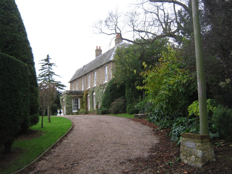
Rectory, now house. 1770 by the Rev. Thomas Randolph, with medieval core and early C19 additions. Front elevation evenly-coursed small blocks of stone with buff brick quoins and dressings. Slate roof. 2 storeys and attic. Mansard roof. Buff brick stack in front slope of roof to left of centre, rear stack to left, and ridge stack towards right end. Skylight. Irregular fenestration of 6 recessed 12-pane sashes with splayed rubbed white brick voussoirs, grouped 2:1:2:1. Similar windows to ground floor. Later ashlared porch under third window from left, with door of 6 fielded panels and cambered heed,in architrave with splayed rubbed white brick voussoirs. C19 rectangular 2-storey stone bay window to left gable end. Narrower, and possibly earlier C18 parallel rear range to left, with C19 stable range with Mansard roof at right-angles to rear to left of it. Interior: only partly inspected. South jamb of a plain-chamfered 4-centred or pointed-arched doorway in thick rear wall, opposite front door.
Listing NGR: TR1567635969
External links are from the relevant listing authority and, where applicable, Wikidata. Wikidata IDs may be related buildings as well as this specific building. If you want to add or update a link, you will need to do so by editing the Wikidata entry.


Other nearby listed buildings