Approximate Location Map
Large Map »
Latitude: 51.2025 / 51°12'8"N
Longitude: 0.6785 / 0°40'42"E
OS Eastings: 587220
OS Northings: 148214
OS Grid: TQ872482
Mapcode National: GBR QTJ.JCV
Mapcode Global: VHJMW.Q12J
Plus Code: 9F326M2H+XC
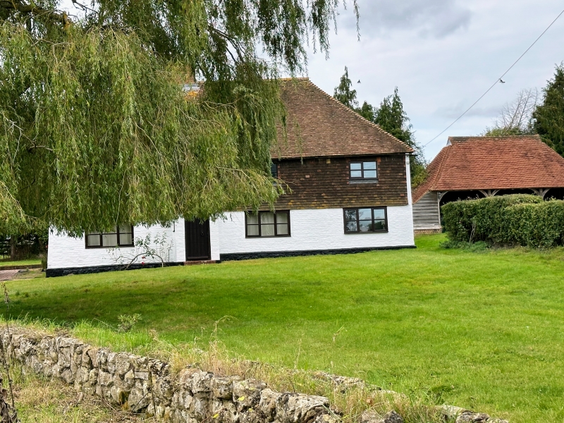
Entry Name: Judge House Farmhouse
Listing Date: 21 October 1986
Grade: II
Source: Historic England
Source ID: 1344320
English Heritage Legacy ID: 174253
ID on this website: 101344320
Location: Broadstone, Maidstone, Kent, ME17
County: Kent
District: Maidstone
Civil Parish: Boughton Malherbe
Traditional County: Kent
Lieutenancy Area (Ceremonial County): Kent
Tagged with: Farmhouse
BOUGHTON MALHERBE WOODCOCK LANE
TQ 84 NE (West Side)
6/20 Judge House Farmhouse
II
Farmhouse. C16 or earlier. Timber framed. Ground floor painted brick, first
floor tile-hung. Plain tile roof. 2 storeys. Steeply pitched hipped roof.
Ridge stack off-centre to left. Irregular fenestration of three 2-light case-
ments. Ribbed door in brick porch under stack. Interior not inspected.
Listing NGR: TQ8722048214
External links are from the relevant listing authority and, where applicable, Wikidata. Wikidata IDs may be related buildings as well as this specific building. If you want to add or update a link, you will need to do so by editing the Wikidata entry.


Other nearby listed buildings
