Latitude: 51.1472 / 51°8'49"N
Longitude: 0.5298 / 0°31'47"E
OS Eastings: 577038
OS Northings: 141699
OS Grid: TQ770416
Mapcode National: GBR PSS.2R2
Mapcode Global: VHJN0.4FDF
Plus Code: 9F324GWH+VW
Entry Name: Chapmans Farmhouse
Listing Date: 25 March 1987
Grade: II
Source: Historic England
Source ID: 1344386
English Heritage Legacy ID: 174632
ID on this website: 101344386
Location: Maidstone, Kent, TN12
County: Kent
District: Maidstone
Civil Parish: Staplehurst
Traditional County: Kent
Lieutenancy Area (Ceremonial County): Kent
Tagged with: Farmhouse
STAPLEHURST PRISTLING LANE TQ 74 SE (North side)
3/162 Chapmans Farmhouse
GV II
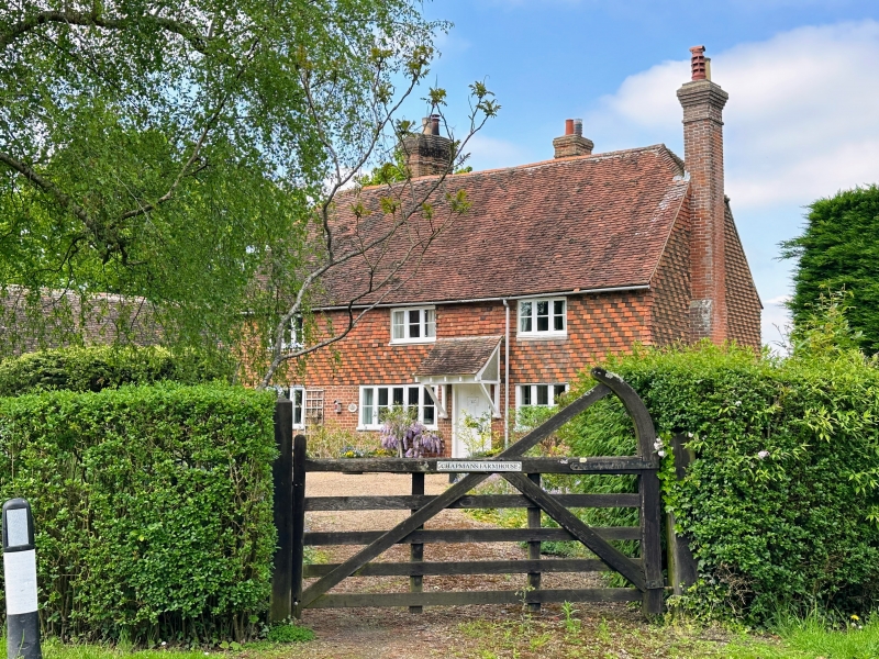
Farmhouse, now house. C17 or earlier, with C19 facade. Ground floor red brick in Flemish bond, first floor hung with diagonal stripes of dark and lighter tiles. Plain tile roof. 2 storeys and garret. Half- hipped roof. Rear stack towards left end and another towards centre. Projecting brick stack to right. Irregular fenestration of three 3- light casements. Panelled door between right and central windows. Rear wing to left. Interior not inspected.
Listing NGR: TQ7589141896
External links are from the relevant listing authority and, where applicable, Wikidata. Wikidata IDs may be related buildings as well as this specific building. If you want to add or update a link, you will need to do so by editing the Wikidata entry.


Other nearby listed buildings