Approximate Location Map
Large Map »
Latitude: 52.7598 / 52°45'35"N
Longitude: -1.9356 / 1°56'8"W
OS Eastings: 404444
OS Northings: 318023
OS Grid: SK044180
Mapcode National: GBR 3B6.X2C
Mapcode Global: WHBF3.7WKN
Plus Code: 9C4WQ357+WQ
Entry Name: 19, Lower Brook Street
Listing Date: 5 July 1972
Grade: II
Source: Historic England
Source ID: 1344620
English Heritage Legacy ID: 271261
ID on this website: 101344620
Location: Rugeley, Cannock Chase, Staffordshire, WS15
County: Staffordshire
District: Cannock Chase
Civil Parish: Rugeley
Built-Up Area: Rugeley
Traditional County: Staffordshire
Lieutenancy Area (Ceremonial County): Staffordshire
Church of England Parish: Brereton and Rugeley
Church of England Diocese: Lichfield
Tagged with: Building
1.
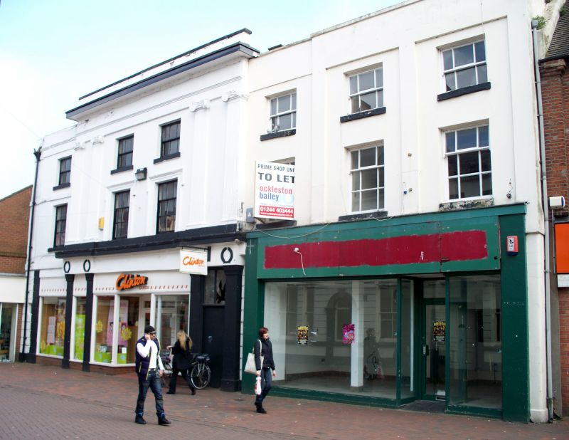
1571 LOWER BROOK STREET
No 19
SK 0418 1/36
II
2.
Early C19. Stucco; 3 storeys; 5 sash windows; plain side and intermediate
pilasters over upper storeys; restored parapet. Modern shop front. Tied
with No 17 which adjoins on left-hand side.
Listing NGR: SK0444418023
External links are from the relevant listing authority and, where applicable, Wikidata. Wikidata IDs may be related buildings as well as this specific building. If you want to add or update a link, you will need to do so by editing the Wikidata entry.


Other nearby listed buildings
