Latitude: 51.0181 / 51°1'5"N
Longitude: -3.1041 / 3°6'14"W
OS Eastings: 322652
OS Northings: 124884
OS Grid: ST226248
Mapcode National: GBR M1.J1G0
Mapcode Global: FRA 46DF.6JZ
Plus Code: 9C3R2V9W+69
Entry Name: 14 and 16, Bridge Street
Listing Date: 4 July 1975
Grade: II
Source: Historic England
Source ID: 1344711
English Heritage Legacy ID: 269635
ID on this website: 101344711
Location: North Town, Somerset, TA1
County: Somerset
District: Somerset West and Taunton
Electoral Ward/Division: Taunton Lyngford
Parish: Taunton
Built-Up Area: Taunton
Traditional County: Somerset
Lieutenancy Area (Ceremonial County): Somerset
Tagged with: Building
1. BRIDGE STREET 5365 (East Side) Nos 14 & 16 ST 2224 NE 9/176
II
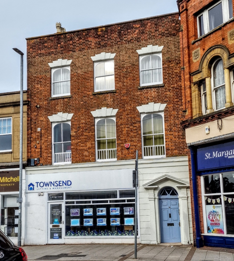
2. Late C18/early C19. 3 storeys. Red brick. Parapet with stone capping. 3 windows with stepped vousosoirs (centre one blocked on 2nd floor). Sashes with curved heads, Frilled hoods for blinds to 1st floor windows. Rusticated ground floor with wooden doorcase to right. Triangular pediment, traceried fanlight and 6-panel door. Modern shop front to left.
Listing NGR: ST2265224884
External links are from the relevant listing authority and, where applicable, Wikidata. Wikidata IDs may be related buildings as well as this specific building. If you want to add or update a link, you will need to do so by editing the Wikidata entry.


Other nearby listed buildings