Latitude: 51.015 / 51°0'54"N
Longitude: -3.1024 / 3°6'8"W
OS Eastings: 322761
OS Northings: 124539
OS Grid: ST227245
Mapcode National: GBR M1.J7V2
Mapcode Global: FRA 46DF.F55
Plus Code: 9C3R2V8X+22
Entry Name: 33, FORE STREET (See details for further address information)
Listing Date: 4 July 1975
Grade: II
Source: Historic England
Source ID: 1344754
English Heritage Legacy ID: 269758
ID on this website: 101344754
Location: Taunton, Somerset, TA1
County: Somerset
District: Somerset West and Taunton
Electoral Ward/Division: Taunton Manor and Wilton
Parish: Taunton
Built-Up Area: Taunton
Traditional County: Somerset
Lieutenancy Area (Ceremonial County): Somerset
Tagged with: Building
1. HAMMET STREET 5365 (South Side) No 18 ST 2224 NE 9/271
II GV
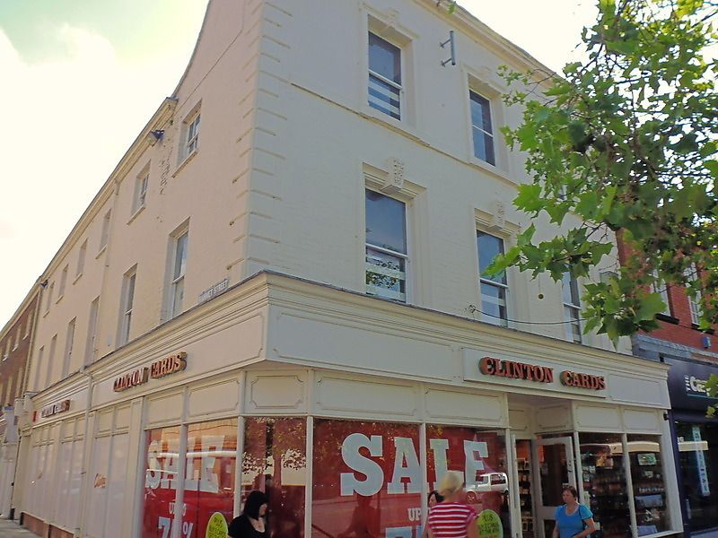
2. With No 33 Fore Street. The end building of Hammet Street with an elevation facing Fore Street. Early/mid C19 detail. Colourwashed. 3 storey 3 window brick front facing west, with parapet swept up to higher level. Banded quoins. Cornice and blocking course. Sillband. Windows with moulded architrave surrounds and foliated keystones. Sashes, no glazing bars. Modern shop front.
All the listed buildings in Hammet Street together with St Mary Magdalene Church and the listed buildings in Church Square form an extremely important group.
Listing NGR: ST2276324537
External links are from the relevant listing authority and, where applicable, Wikidata. Wikidata IDs may be related buildings as well as this specific building. If you want to add or update a link, you will need to do so by editing the Wikidata entry.


Other nearby listed buildings