Approximate Location Map
Large Map »
Latitude: 51.1499 / 51°8'59"N
Longitude: -3.0618 / 3°3'42"W
OS Eastings: 325829
OS Northings: 139491
OS Grid: ST258394
Mapcode National: GBR M3.7S46
Mapcode Global: VH7DG.WC6C
Plus Code: 9C3R4WXQ+W7
Entry Name: Brooklands
Listing Date: 24 June 1985
Grade: II
Source: Historic England
Source ID: 1344929
English Heritage Legacy ID: 268850
ID on this website: 101344929
Location: Cannington, Somerset, TA5
County: Somerset
District: Sedgemoor
Civil Parish: Cannington
Built-Up Area: Cannington
Traditional County: Somerset
Lieutenancy Area (Ceremonial County): Somerset
Tagged with: Building
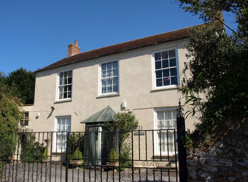
ST23NE CANNINGTON CF BROOK LANE (East side)
12/4 Brooklands
-
GV II
House. Early C19. Pebbledashed, tile roof, end brick stacks. Symmetrical frontage, 2 storeys, 3 bays, virtually flush
mounted 12-pane sash windows with exposed sash boxes. Central door opening in a semi-circular head stone surround,
6-panelled door, fanlight with radiating glazing bars; projecting open porch with hipped glazed roof, ornamental
cast-iron supports. Included primarily for group value with Church of St Mary (qv).
Listing NGR: ST2582839493
External links are from the relevant listing authority and, where applicable, Wikidata. Wikidata IDs may be related buildings as well as this specific building. If you want to add or update a link, you will need to do so by editing the Wikidata entry.


Other nearby listed buildings
