Approximate Location Map
Large Map »
Latitude: 51.2697 / 51°16'10"N
Longitude: -2.4375 / 2°26'15"W
OS Eastings: 369572
OS Northings: 152369
OS Grid: ST695523
Mapcode National: GBR MY.0883
Mapcode Global: VH89P.PCQ0
Plus Code: 9C3V7H96+VX
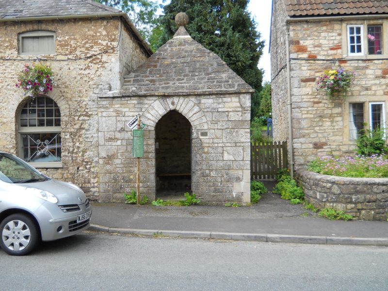
Entry Name: Blind House
Listing Date: 11 March 1968
Grade: II
Source: Historic England
Source ID: 1345102
English Heritage Legacy ID: 267957
ID on this website: 101345102
Location: Kilmersdon, Somerset, BA3
County: Somerset
District: Mendip
Civil Parish: Kilmersdon
Traditional County: Somerset
Lieutenancy Area (Ceremonial County): Somerset
Tagged with: House
KILMERSDON CP
ST65SE
KILMERSDON VILLAGE
11/174 Blind House
11.3.68
GV II
Lock-up, now bus shelter. C17. Coursed and squared rubble, pyramidal stone-tiled roof with ball finial at apex. Square
on plan. Door opening to roadside with segmental-pointed arch head, wrought-iron gate; (studded plank door missing at
time of resurvey, May 1985).
Listing NGR: ST6957052370
External links are from the relevant listing authority and, where applicable, Wikidata. Wikidata IDs may be related buildings as well as this specific building. If you want to add or update a link, you will need to do so by editing the Wikidata entry.


Other nearby listed buildings
