Approximate Location Map
Large Map »
Latitude: 51.1828 / 51°10'58"N
Longitude: -3.4442 / 3°26'38"W
OS Eastings: 299157
OS Northings: 143608
OS Grid: SS991436
Mapcode National: GBR LK.5R9R
Mapcode Global: VH6GM.8J2M
Plus Code: 9C3R5HM4+48
Entry Name: Kennels, at East Side of Entrance to Castle Home Farmyard
Listing Date: 4 August 1983
Grade: II
Source: Historic England
Source ID: 1345589
English Heritage Legacy ID: 264644
ID on this website: 101345589
Location: Dunster, Somerset, TA24
County: Somerset
District: Somerset West and Taunton
Civil Parish: Dunster
Built-Up Area: Dunster
Traditional County: Somerset
Lieutenancy Area (Ceremonial County): Somerset
Tagged with: Kennel
1.
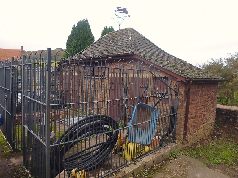
5366 DUNSTER CASTLE HILL
Kennels, at east side of entrance
to Castle Home Farmyard
SS 9843-9943 4/12
II GV
2.
Probably late 19th century. Random rubble, shingled hipped roof swept down at either
end, small single storey structure divided into four compartments with wrought iron
railed compounds in front. Each compartment has a single, square, tophung plain
boarded window and a flat headed doorway with stable type door. Weather vane on
ridge surmounted by a hare. A good and unaltered example of an unusual type of
building.
Listing NGR: SS9915743608
External links are from the relevant listing authority and, where applicable, Wikidata. Wikidata IDs may be related buildings as well as this specific building. If you want to add or update a link, you will need to do so by editing the Wikidata entry.


Other nearby listed buildings
