Latitude: 51.1825 / 51°10'57"N
Longitude: -3.4451 / 3°26'42"W
OS Eastings: 299089
OS Northings: 143580
OS Grid: SS990435
Mapcode National: GBR LK.5R25
Mapcode Global: VH6GM.7JKV
Plus Code: 9C3R5HM3+2W
Entry Name: 7, Castle Hill
Listing Date: 4 August 1983
Grade: II
Source: Historic England
Source ID: 1345590
English Heritage Legacy ID: 264649
ID on this website: 101345590
Location: Dunster, Somerset, TA24
County: Somerset
District: Somerset West and Taunton
Civil Parish: Dunster
Built-Up Area: Dunster
Traditional County: Somerset
Lieutenancy Area (Ceremonial County): Somerset
Tagged with: Building
1. 5366 DUNSTER CASTLE HILL
No 7 SS 9843-9943 4/18
II GV
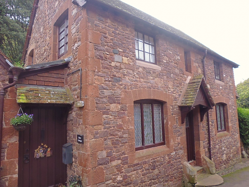
2. Early 19th century with later alterations. Random rubble red sandstone, ashlar quoins and dressings to openings. Plain tile roof, brick chimney stacks. Tile hanging to west gable at first floor supported on wooden brackets. Two storeys. Two casement windows, small paned, diamond shaped glazing to ground floor windows. Modern door under gabled hood on brackets. 1½ storey gabled wing to east. Included for group value.
Listing NGR: SS9909743579
External links are from the relevant listing authority and, where applicable, Wikidata. Wikidata IDs may be related buildings as well as this specific building. If you want to add or update a link, you will need to do so by editing the Wikidata entry.


Other nearby listed buildings