Approximate Location Map
Large Map »
Latitude: 53.8422 / 53°50'31"N
Longitude: -0.4307 / 0°25'50"W
OS Eastings: 503354
OS Northings: 439576
OS Grid: TA033395
Mapcode National: GBR TSF0.KF
Mapcode Global: WHGF4.CP5D
Plus Code: 9C5XRHR9+VP
Entry Name: 17, Toll Gavel
Listing Date: 2 July 1969
Grade: II
Source: Historic England
Source ID: 1346398
English Heritage Legacy ID: 167476
ID on this website: 101346398
Location: Beverley, East Riding of Yorkshire, HU17
County: East Riding of Yorkshire
Civil Parish: Beverley
Built-Up Area: Beverley
Traditional County: Yorkshire
Lieutenancy Area (Ceremonial County): East Riding of Yorkshire
Church of England Parish: Beverley St Mary
Church of England Diocese: York
Tagged with: Building
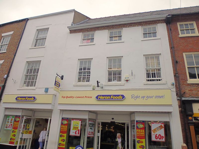
BEVERLEY TOLL GAVEL
TA 0339 (east side)
9/349 No 17
2.7.69
GV II
Circa 1780. Stuccoed. Three storeys. Rebuilt brick cornice. Slate roof.
Three hung sash windows with exposed frames and glazing bars. Modern shop
front. The same building as Nos 19 and 21.
Listing NGR: TA0335439576
External links are from the relevant listing authority and, where applicable, Wikidata. Wikidata IDs may be related buildings as well as this specific building. If you want to add or update a link, you will need to do so by editing the Wikidata entry.


Other nearby listed buildings
