Latitude: 51.7522 / 51°45'7"N
Longitude: -0.3395 / 0°20'22"W
OS Eastings: 514716
OS Northings: 207245
OS Grid: TL147072
Mapcode National: GBR H89.4Z6
Mapcode Global: VHGPQ.27C4
Plus Code: 9C3XQM26+V5
Entry Name: 27, Market Place
Listing Date: 27 August 1971
Grade: II
Source: Historic England
Source ID: 1347170
English Heritage Legacy ID: 163372
ID on this website: 101347170
Location: St Albans, St. Albans, Hertfordshire, AL3
County: Hertfordshire
District: St. Albans
Electoral Ward/Division: St Peters
Parish: Non Civil Parish
Built-Up Area: St Albans
Traditional County: Hertfordshire
Lieutenancy Area (Ceremonial County): Hertfordshire
Church of England Parish: St Albans St Peter
Church of England Diocese: St.Albans
Tagged with: Building
MARKET PLACE 1. (West Side) 1582 No 27
TL 1407 SE 9/249
II
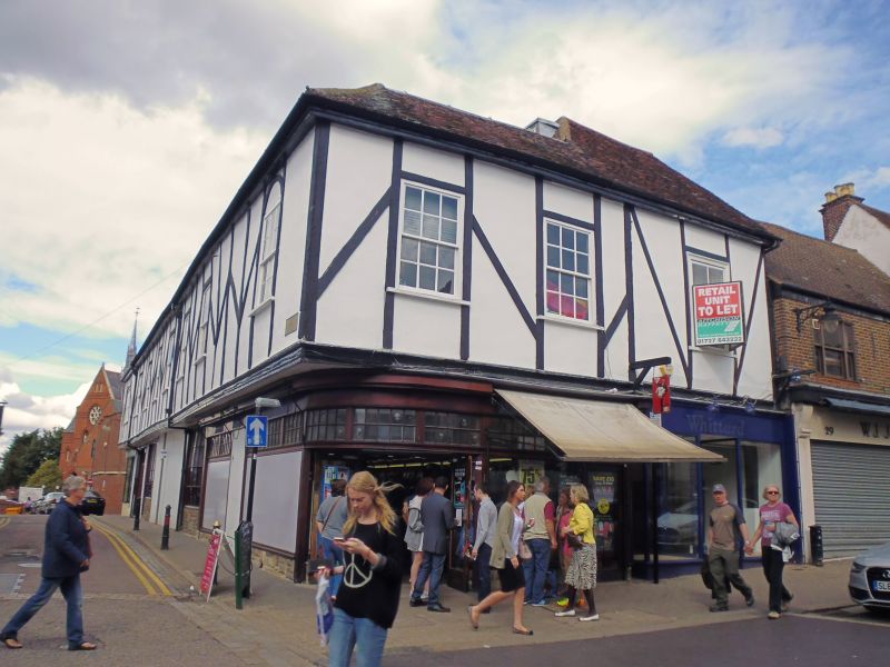
2. Originally part of the Moot House, described under No 25, with which its high pitched, tiled roof is common. 2 storeys, one window. 1st floor, plastered with mock timber framing applied, has one sash window in slightly projecting box frame. Modern shop on ground floor.
Listing NGR: TL1471607245
External links are from the relevant listing authority and, where applicable, Wikidata. Wikidata IDs may be related buildings as well as this specific building. If you want to add or update a link, you will need to do so by editing the Wikidata entry.


Other nearby listed buildings