Latitude: 52.3759 / 52°22'33"N
Longitude: -2.3145 / 2°18'52"W
OS Eastings: 378685
OS Northings: 275364
OS Grid: SO786753
Mapcode National: GBR 0BK.3MV
Mapcode Global: VH91S.TJRZ
Plus Code: 9C4V9MGP+95
Entry Name: 5, Load Street
Listing Date: 22 April 1950
Grade: II
Source: Historic England
Source ID: 1348277
English Heritage Legacy ID: 156802
ID on this website: 101348277
Location: Bewdley, Wyre Forest, Worcestershire, DY12
County: Worcestershire
District: Wyre Forest
Civil Parish: Bewdley
Built-Up Area: Bewdley
Traditional County: Worcestershire
Lieutenancy Area (Ceremonial County): Worcestershire
Church of England Parish: Ribbesford with Bewdley and Dowles etc
Church of England Diocese: Worcester
Tagged with: Building
SO 7875 SE BEWDLEY CP LOAD STREET (south side)
13/157 No 5
22.4.50
GV II
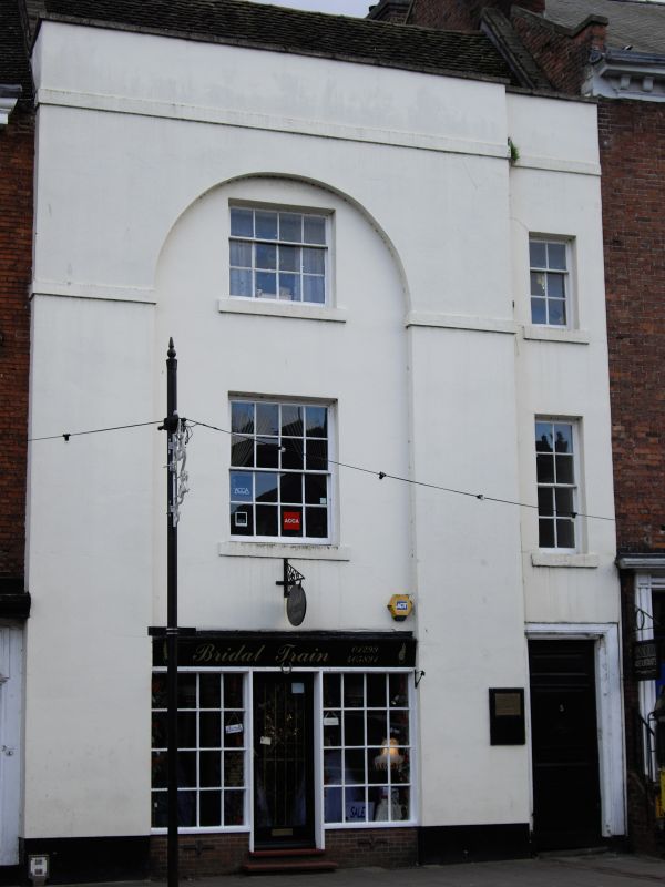
House, now shop and offices. Probably early C18, refronted early C19, with some mid-C20 alterations. Rendered brick, tile roof, rear stack. Three storeys, stone coped parapet with plain band as cornice; the main part of the front is recessed with semi-circular head to second floor; two windows: 16-pane sash in recess to left, 8-pane sash to right; second floor: 12-pane sash to left, 6-pane to right; ground floor: shop front to left in recess with sign board across top, central entrance flanked by multi-pane C20 shop windows, glazed door; entrance to a passage to right- hand corner has a moulded wooden architrave, door of three raised and fielded panels.
Listing NGR: SO7868575364
External links are from the relevant listing authority and, where applicable, Wikidata. Wikidata IDs may be related buildings as well as this specific building. If you want to add or update a link, you will need to do so by editing the Wikidata entry.


Other nearby listed buildings