Latitude: 51.7071 / 51°42'25"N
Longitude: -0.0544 / 0°3'15"W
OS Eastings: 534530
OS Northings: 202720
OS Grid: TL345027
Mapcode National: GBR KCQ.YWY
Mapcode Global: VHGQ2.0CL5
Plus Code: 9C3XPW4W+R6
Entry Name: Cheshunt Great House (Remains)
Listing Date: 11 June 1954
Grade: II
Source: Historic England
Source ID: 1348371
English Heritage Legacy ID: 157317
ID on this website: 101348371
Location: Churchgate, Broxbourne, Hertfordshire, EN7
County: Hertfordshire
District: Broxbourne
Electoral Ward/Division: Rosedale and Bury Green
Parish: Non Civil Parish
Built-Up Area: Cheshunt
Traditional County: Hertfordshire
Lieutenancy Area (Ceremonial County): Hertfordshire
Church of England Parish: Cheshunt
Church of England Diocese: St.Albans
Tagged with: Manor house English country house
1. 5251 CHESHUNT
GOFF'S LANE (north side) Cheshunt Cheshunt Great House (remains) TL 3402 : 11/43 11.6.54
II
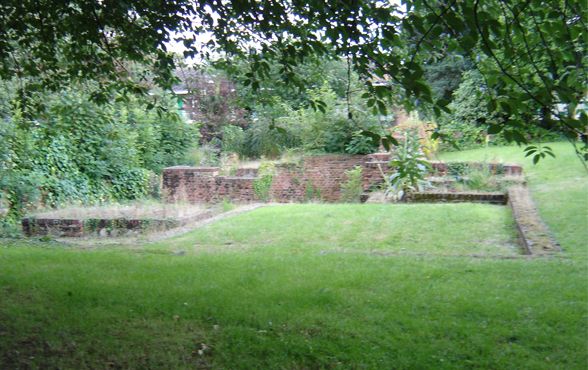
2. C15 house, burnt 1965, at which time it consisted of one wing of a courtyard house, containing a hall (formerly longer) with C15 timber roof with wind-braces and an early C18 staircase. Exterior was cased in brick, 1762-72, and alterations made after 1806 when a Gothick entrance facade was added to S end of hall. Cellar and portions of W wall remain. Red brick with modern coping. 3 rooms each with marble flooring, that on N with some patterned terracotta tiling, S room (undercroft to hall) has black and white marble floor and remains of 5 stone and cemented- brick octagonal columns with moulded bases and capitals. Remains of attached octagonal staircase tower on SW angle. Some C15 roof wind braces fixed to walls. Stone base of 1806 entrance porch on S side. (Pevsner (1977) ).
Listing NGR: TL3453002720
External links are from the relevant listing authority and, where applicable, Wikidata. Wikidata IDs may be related buildings as well as this specific building. If you want to add or update a link, you will need to do so by editing the Wikidata entry.


Other nearby listed buildings