Latitude: 51.224 / 51°13'26"N
Longitude: 1.2352 / 1°14'6"E
OS Eastings: 625992
OS Northings: 152173
OS Grid: TR259521
Mapcode National: GBR W0D.739
Mapcode Global: VHLGX.CHBK
Plus Code: 9F3366FP+H3
Entry Name: White House Farmhouse
Listing Date: 3 December 1986
Grade: II
Source: Historic England
Source ID: 1348670
English Heritage Legacy ID: 177983
ID on this website: 101348670
Location: Nonington, Dover, Kent, CT15
County: Kent
District: Dover
Civil Parish: Nonington
Built-Up Area: Nonington
Traditional County: Kent
Lieutenancy Area (Ceremonial County): Kent
Tagged with: Farmhouse
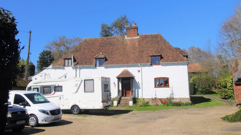
NONINGTON EASOLE STREET TR 25 SE (west side) 3/122 White House Farmhouse GV II House. C15 altered C17 and clad C18. Timber framed and clad with painted brick with plain tiled roof. Originally a hall house plan with at least 1 jettied crosswing and possibly a Wealden. One storey and basement and attic on plinth with brick modillion eaves cornice to hipped roof with gablets, 3 hipped semi-dormers and stacks to centre right and to end left. Three segmentally headed wooden casements on ground floor and half-glazed door to centre right with flat hood. Basement opening to left. Outshots to left and to rear. Interior; arched braced framed partitions and dragon beam survive. Ceiling joists with tongued chamfer stops. Main stack built of chalk blocks with red brick repairs, ground floor with inglenooks. Roof with staggered purlins and queen struts, the whole raised up about 18 inches off the wall plate when the hall was ceiled in and now supported by posts resting on the tie beams.
Listing NGR: TR2599252173
External links are from the relevant listing authority and, where applicable, Wikidata. Wikidata IDs may be related buildings as well as this specific building. If you want to add or update a link, you will need to do so by editing the Wikidata entry.


Other nearby listed buildings