Approximate Location Map
Large Map »
Latitude: 52.0779 / 52°4'40"N
Longitude: -3.1242 / 3°7'27"W
OS Eastings: 323049
OS Northings: 242770
OS Grid: SO230427
Mapcode National: GBR F1.C7N0
Mapcode Global: VH6BJ.S1PD
Plus Code: 9C4R3VHG+58
Entry Name: Bridge
Listing Date: 16 November 1984
Grade: II
Source: Historic England
Source ID: 1348923
English Heritage Legacy ID: 153737
ID on this website: 101348923
Location: County of Herefordshire, HR3
County: Powys - Powys
Civil Parish: Cusop
Built-Up Area: Hay-on-Wye
Traditional County: Brecknockshire
Church of England Parish: Cusop
Church of England Diocese: Hereford
Tagged with: Bridge Road bridge
CUSOP CP
SO 24 SW
4/116
NEWPORT STREET (off west side)
Hay on Wye
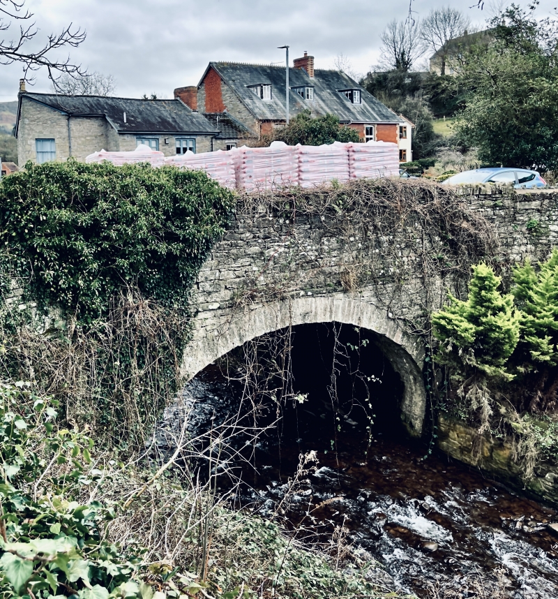
Bridge
GV
II
Bridge, now disused and situated parallel to road. Early C19 with later alterations, possibly by John Gethin, surveyor. Rubble with ashlar dressings. Elliptical arch with keystone, plain band above; parapet raised in rubble with concrete capping, probably early C20.
This entry was subject to a Minor Amendment on 1 November 2016.
External links are from the relevant listing authority and, where applicable, Wikidata. Wikidata IDs may be related buildings as well as this specific building. If you want to add or update a link, you will need to do so by editing the Wikidata entry.


Other nearby listed buildings
