Approximate Location Map
Large Map »
Latitude: 50.9615 / 50°57'41"N
Longitude: -1.1376 / 1°8'15"W
OS Eastings: 460663
OS Northings: 118364
OS Grid: SU606183
Mapcode National: GBR 98S.M6X
Mapcode Global: FRA 86HK.QNK
Plus Code: 9C2WXV66+JX
Entry Name: Meon House
Listing Date: 6 March 1967
Grade: II
Source: Historic England
Source ID: 1350608
English Heritage Legacy ID: 146410
ID on this website: 101350608
Location: Droxford, Winchester, Hampshire, SO32
County: Hampshire
District: Winchester
Civil Parish: Droxford
Built-Up Area: Droxford
Traditional County: Hampshire
Lieutenancy Area (Ceremonial County): Hampshire
Church of England Parish: Droxford St Mary and All Saints
Church of England Diocese: Portsmouth
Tagged with: House
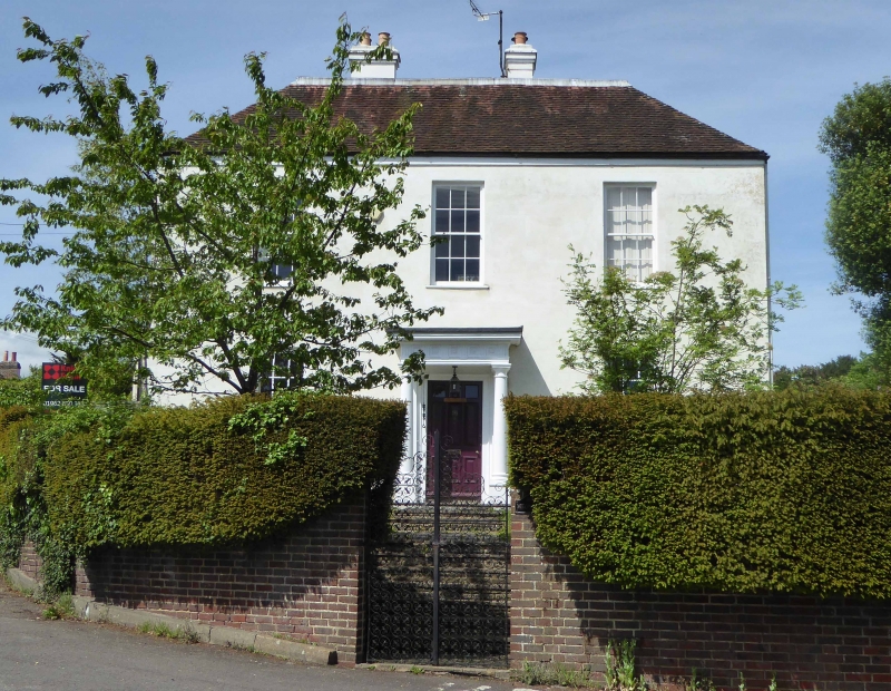
SU 61 NW DROXFORD THE SQUARE
7/26 Meon House
6.3.67 (formerly Sunnyside)
GV II
House. Late C18. Walls of stucco, some painted brickwork. Hipped tile roof.
Symmetrical south front elevation of two storeys three windows. Sashes in
reveals. Doric porch, triglyphs, two pilasters and two columns, architrave,
and 9-panelled (3 top glazed) door.
Listing NGR: SU6066018367
External links are from the relevant listing authority and, where applicable, Wikidata. Wikidata IDs may be related buildings as well as this specific building. If you want to add or update a link, you will need to do so by editing the Wikidata entry.


Other nearby listed buildings
