Approximate Location Map
Large Map »
Latitude: 51.3853 / 51°23'7"N
Longitude: 1.3841 / 1°23'2"E
OS Eastings: 635559
OS Northings: 170580
OS Grid: TR355705
Mapcode National: GBR WZZ.2RJ
Mapcode Global: VHLG6.YF2V
Plus Code: 9F3399PM+4J
Entry Name: 18A, St John's Road
Listing Date: 22 February 1973
Grade: II
Source: Historic England
Source ID: 1351086
English Heritage Legacy ID: 356670
ID on this website: 101351086
Location: Margate, Thanet, Kent, CT9
County: Kent
District: Thanet
Electoral Ward/Division: Margate Central
Parish: Non Civil Parish
Built-Up Area: Margate
Traditional County: Kent
Lieutenancy Area (Ceremonial County): Kent
Tagged with: Building
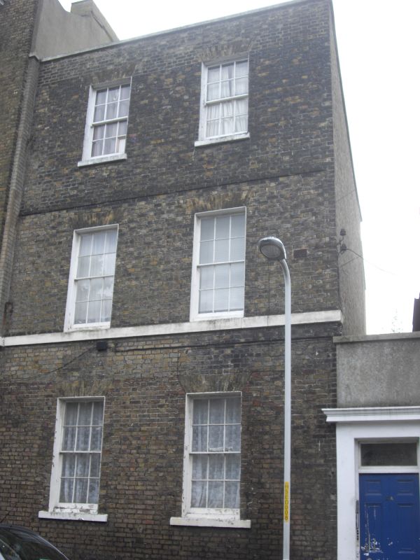
ST JOHN'S ROAD
1.
1380
(South West Side)
No 18A
TR 3570 NE 6/293
II GV
2.
Early C19. 3 storeys and basement brown brick. Stone coping. 2 sashes with
glazing bars intact. Stringcourses. Doorcase on an extension at the side has
a moulded surround, rectangular fanlight and 6 fielded panelled door. Spear
railings.
Nos 18 and 18A form a group
Listing NGR: TR3555970580
External links are from the relevant listing authority and, where applicable, Wikidata. Wikidata IDs may be related buildings as well as this specific building. If you want to add or update a link, you will need to do so by editing the Wikidata entry.


Other nearby listed buildings
