Latitude: 50.9183 / 50°55'5"N
Longitude: 0.4844 / 0°29'3"E
OS Eastings: 574726
OS Northings: 116146
OS Grid: TQ747161
Mapcode National: GBR PWF.99N
Mapcode Global: FRA C6XP.0K3
Plus Code: 9F22WF9M+8Q
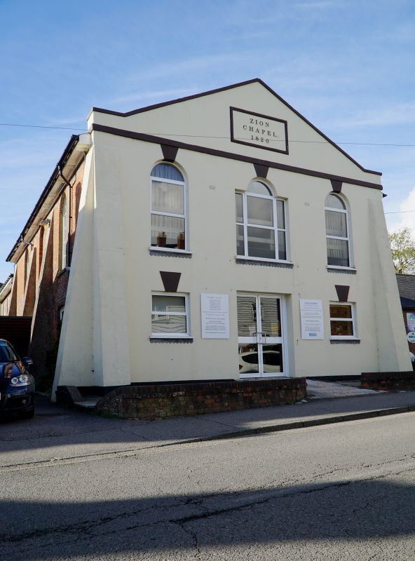
Entry Name: The Zion Chapel
Listing Date: 13 May 1987
Grade: II
Source: Historic England
Source ID: 1352856
English Heritage Legacy ID: 292204
ID on this website: 101352856
Location: Battle, Rother, East Sussex, TN33
County: East Sussex
District: Rother
Civil Parish: Battle
Built-Up Area: Battle
Traditional County: Sussex
Lieutenancy Area (Ceremonial County): East Sussex
Church of England Parish: Battle St Mary the Virgin
Church of England Diocese: Chichester
Tagged with: Chapel
TQ 7416-7516 BATTLE MOUNT STREET
(west side)
40/20 The Zion Chapel
GV II
Dated 1820. Two storeys. Three windows. Red brick, east front stuccoed.
Buttresses flank the front. Cornice. Gable over masquerading as a pediment
Slate roof. Round headed windows on first floor. Gabled porch.
Listing NGR: TQ7471816147
External links are from the relevant listing authority and, where applicable, Wikidata. Wikidata IDs may be related buildings as well as this specific building. If you want to add or update a link, you will need to do so by editing the Wikidata entry.


Other nearby listed buildings